Archive
Older News & Events
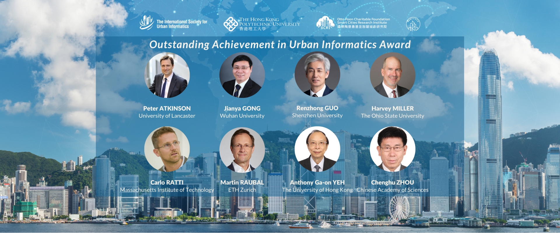
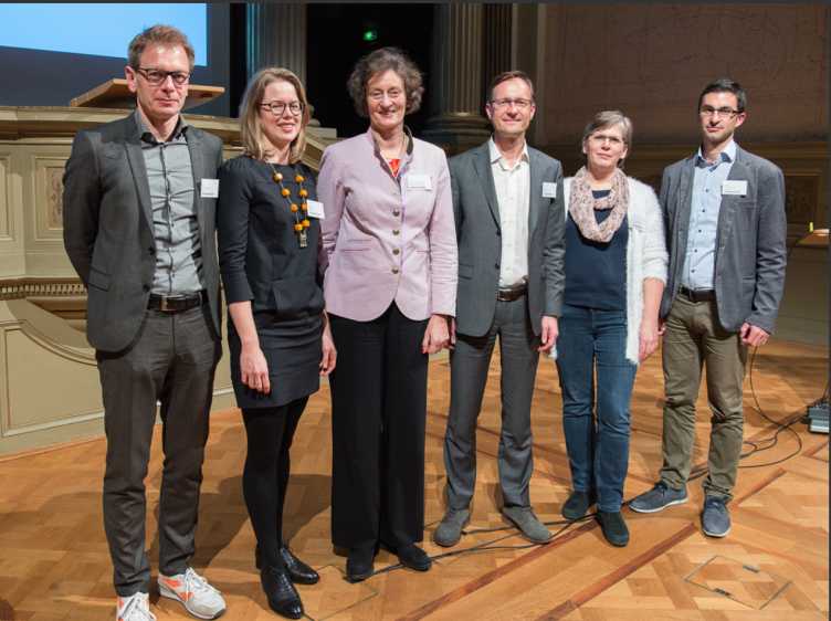
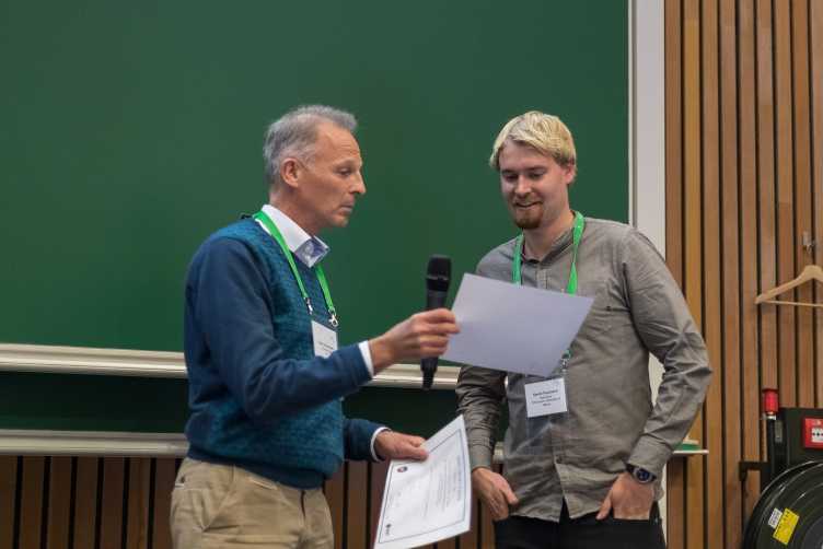
Outstanding Achievement in Urban Informatics Award
October 2023
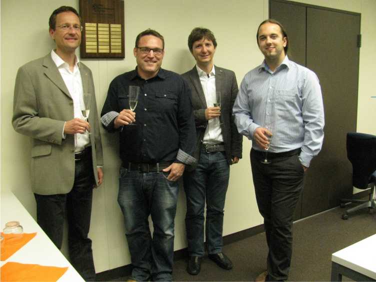
The external pageInternational Society for Urban Informatics awarded Martin Raubal with the award 2023!
Congratulations to Martin, Professor at the chair of Geoinformation-Engineering at ETH Zurich!
AGILE 2023 - Successful Conference Participation
June 2023
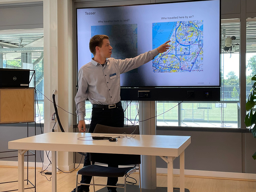
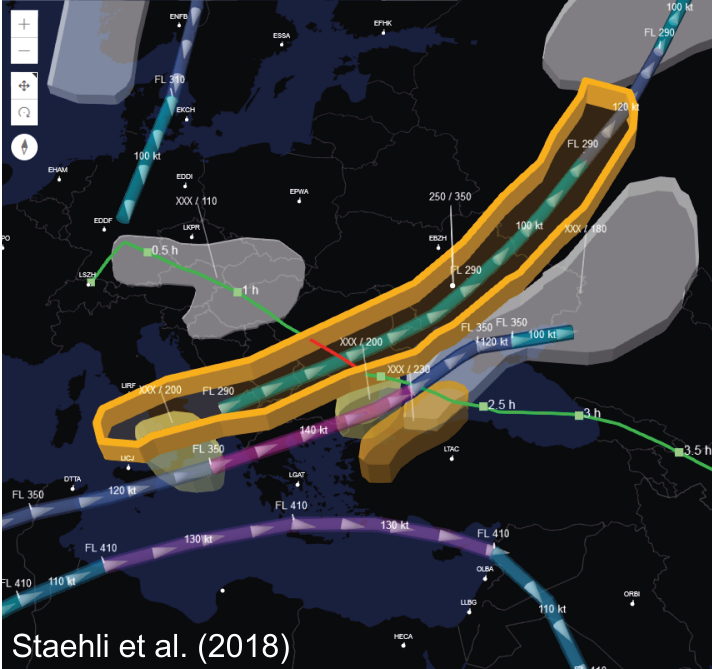
At this year’s AGILE conference on Geographic Information Science in Delft (The Netherlands) Adrian Sarbach presented the results of our research on visualisation and perception of airspace structures on aeronautical charts.
This paper contains a theoretical cartographic analysis on aeronautical charts used for flights following visual flight rules, and the results of a user study, which confirmed the findings from the theoretical analysis.
If you are interested in reading the full open access paper you may do so: external pageEvaluating and Comparing Airspace Structure Visualisation and Perception on Digital Aeronautical Charts.
Spatial data and data analytics for sustainable mobility

March 2023
First CSFM seminar with Professor Martin Raubal from IKG ETH Zurich and Thomas Hettinger from SBB on spatial data and data analytics for sustainable mobility including an Apéro will be held on 23 March 2023, 17:00 - 18:00 plus plus Apéro at ETH Zentrum.
Please register: Webregistration
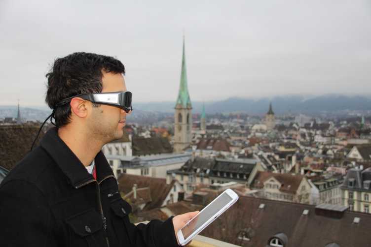
Eyes4ICU: Gaze-Based Interaction and Location-Based Services
November 2022
The external pagegeoGAZElab is participating in the European project “Eyes for Interaction, Communication, and Understanding (external pageEyes4ICU)”.
Eyes4ICU is a Doctoral Network in the scope of the EU Marie Skłodowska-Curie Actions. We are participating as an Associated Partner, receiving our funding from the external pageSwiss State Secretariat for Education, Research and Innovation.
Eyes4ICU explores novel forms of gaze-based interaction that rely on current psychological theories and findings, computational modelling, as well as expertise in highly promising application domains. In this context, the geoGAZElab is investigating gaze-based interaction with location-based services, focusing particularly on Gaze-supported Trip Recommendation and Gaze-supported Travel Experience Logging.
Digital Underground: Learning from Singapore
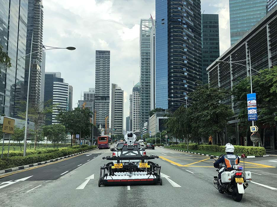
September 2022
Spatial planning in the underground is becoming increasingly important. As part of the pioneering project "Digital Underground", an international research team led by D-BAUG professors Martin Raubal and Andreas Wieser is developing a 3D map of the underground in Singapore. The digital twin will help to save time and costs in construction and increase worker safety. The mapping initiative has model character and could also find applications in Switzerland in the future. Link to article
Digital Underground CH - Workshop on 6 September 2022
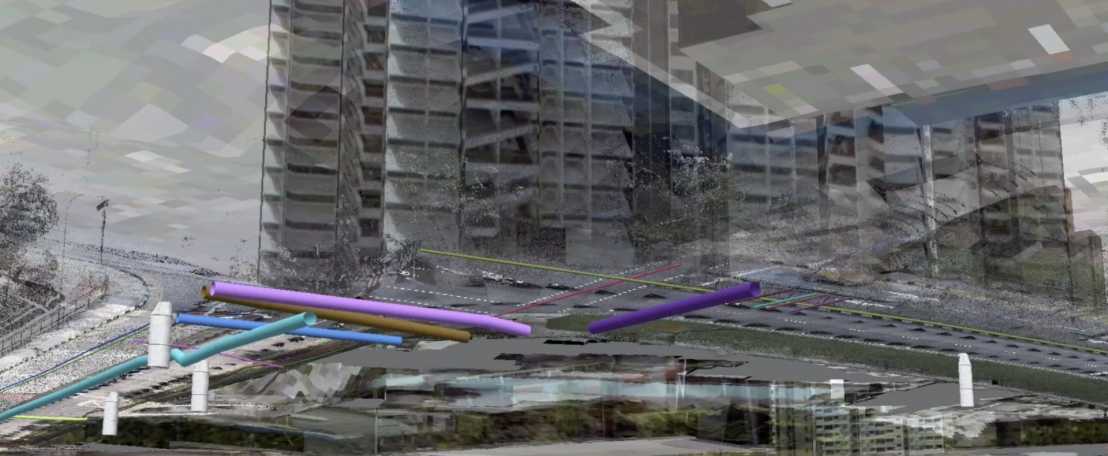
September 2022
The continuing densification in cities also affects the underground. Developing digital twins of the underground and applying geoinformation technology will be essential for planning, developing, and managing the underground.
This comes with a variety of significant challenges like assuring the availability of spatio-temporal data of sufficient quality, clearly defined and accessible interfaces, and reliable workflows which include all stakeholders (e.g., agencies, planners, surveyors, utility providers).
This one-day workshop aims at identifying the needs and required actions for establishing the digital underground of Switzerland, as well as at discussing the necessary frameworks and technological solutions. The workshop will be held in English. It comprises presentations by experts from Switzerland and abroad, as well as a moderated discussion among the participants.
Registration Fee (including Coffee breaks and Apéro) is CHF 100
Registration via Mail to
Best Paper Award at AGILE Conference
June 2022
We are happy to announce that our paper received the Best Paper Award at the 25th AGILE Conference on Geographic Information Science! Our PhD student Nina Wiedemann presented the paper in Vilnius, Lithuania, and it was elected by the audience out of three papers pre-selected by the conference committee. In the paper “Unlocking social network analysis methods for studying human mobility” we demonstrate how network modelling methods can help to gain insights into the topology and spatial layout of mobility graphs. For more details, see the publication in the Agile proceedings.
Charging electric vehicles with photovoltaics at home
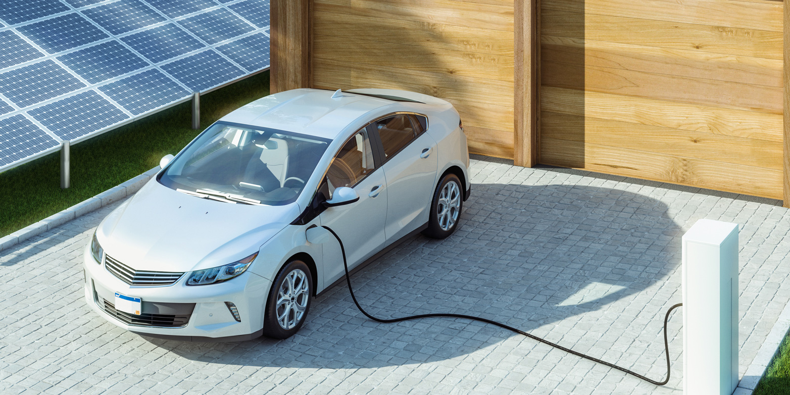
January 2022
An electric car that runs on PV power sounds appealing. But is it really possible to enjoy flexibility with a vehicle charged through a home photovoltaic system? An ETH research team has reached some surprising conclusions.
The area of photovoltaics (PV) is rapidly increasing in popularity, and in Switzerland it already covers 5 percent of the country’s electricity consumption. Electromobility is also seeing strong growth – with currently 70,000 pure electric vehicles on Swiss roads, plus 200,000 hybrids. Martin Raubal, Professor of Geoinformation Engineering at ETH Zurich, welcomes the development: “The mobility sector is responsible for about a third of greenhouse gases in Switzerland. Electromobility is one way to reduce CO2 emissions from transport.”
Going Deeper: Leading Digital Underground into 3.0

November 2021
In a Q&A with the new principal investigator of Digital Underground at the Singapore-ETH Centre, Martin Raubal, who is also Professor for Geoinformation Engineering at ETH Zurich, we get to know him and understand what is needed for data reliability and sustained impact.
Read the whole interview on the website of Singapore ETH Center and find more information on external pageDigital Underground.
Urban Sustainability R&D e-Symposia webinar: Analytics and the City

November 2021
On 19 November, Prof. Dr. Martin Raubal will be speaking at MND's Urban Sustainability R&D e-Symposia webinar on Urban Analytics. He is the Cluster Leader of Distributed Cognition for Social Resilience at FRS, and the Principal Investigator for the Spatiotemporal Analysis for Weak Signals Detection module.
Interpretable and Robust Machine Learning for Mobility Analysis
October 2021
Within the scope of the new program "Hasler Responsible AI" the project "Interpretable and Robust Machine Learning for Mobility Analysis" was accepted and will be fundend. Together with the project partner external pageSwiss Data Science Center we aim to facilitate the deployment of AI in intelligent transportation systems and build a safer, more efficient, and more sustainable transportation system in the future.
3D Sketch Maps

August 2021
The 3D Sketch Maps project, funded by the Swiss National Science Foundation in the scope of the Sinergia funding program, investigates 3D sketch maps from a theoretical, empirical, cognitive, as well as tool-related perspective, with a particular focus on Extended Reality (XR) technologies. Sketch mapping is an established research method in fields that study human spatial decision-making and information processing, such as navigation and wayfinding. Although space is naturally three-dimensional (3D), contemporary research has focused on assessing individuals’ spatial knowledge with two-dimensional (2D) sketches. For many domains though, such as aviation or the cognition of complex multilevel buildings, it is essential to study people’s 3D understanding of space, which is not possible with the current 2D methods.
The 4-year project will be carried out jointly by the Chair of Geoinformation Engineering, the Chair of Cognitive Science at ETH Zurich (Prof. Dr. Christoph Hölscher), and the Spatial Intelligence Lab at University of Münster (external pageProf. Dr. Angela Schwering).
Vehicle to Grid and Car Sharing
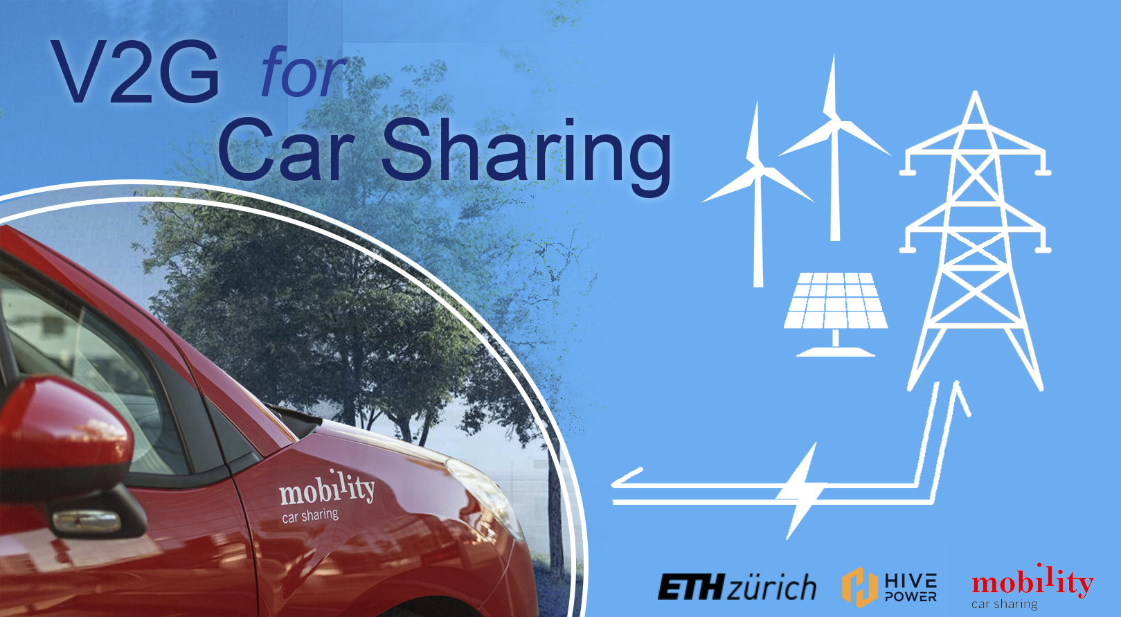
August 2021
A new project V2G4CarSharing in collaboration with external pageHive Power and external pageMobility is funded by the Swiss Federal Office of Energy (SFOE). The project aims to develop and evaluate optimal strategies to integrate car-sharing and Vehicle-to-Grid (V2G). This project will enrich our understanding of the feasibility and benefits of combining car-sharing and V2G, and provide valuable guidelines to support industrial implementations. The project will start on October 1st, 2021 with the MIE Lab as the lead research team. More information can be found here.
Position filled with Nina Wiedemann
New aviation project and open PhD position
April 2021
The Swiss Federal Office of Civil Aviation will be funding our project "The Expanded Flight Deck – Improving the Weather Situation Awareness of Pilots" (external pageEFDISA). The project aims at improving contemporary pre-flight and in-flight representations of weather data for pilots. This will allow pilots to better perceive, understand, and anticipate meteorological hazards.
We are looking for motivated candidates to fill our open PhD position in this project in the geoGAZElab starting July 2021. For more information and applications follow this Link.
Position filled with Adrian Sarbach
Building a Geospatial Legacy at the Swiss Federal Institute of Technology
February 2021
An article on the Esri© website featuring the successful collaboration with different labs at ETH Zurich has been published. Since Martin Raubal’s appointment as Professor for Geoinformation Engineering he has been promoting the use of cutting edge technology within the curriculum and many successful student theses using Esri software have won prizes such as the EDC Student of the Year award.
HoloNav
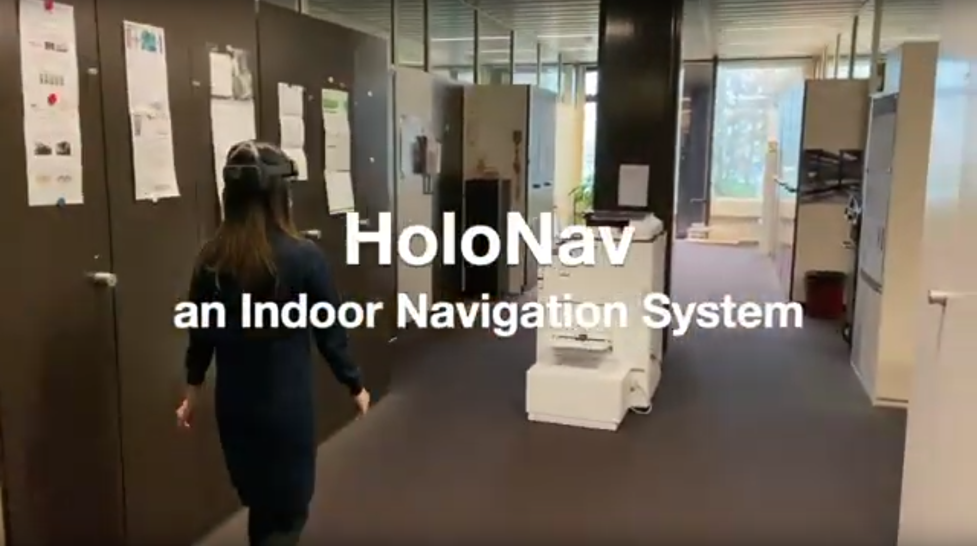
January 2021
In the scope of their interdisciplinary project thesis in autumn 2020, three Geomatics Master students have developed an indoor navigation system for Microsoft HoloLens 2. The system was implemented using Esri CityEngine, Unity, and Microsoft Visual Studio. With a user study, the students tested different types of navigation support and map visualizations, as well as the general suitability of HoloLens 2 for indoor navigation systems.
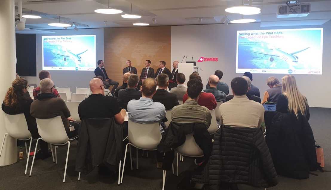
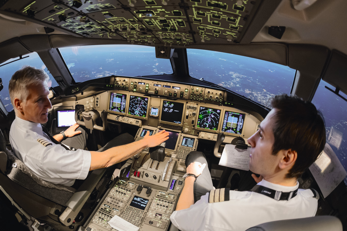
Workshop talk: Flight safety – Line of sight
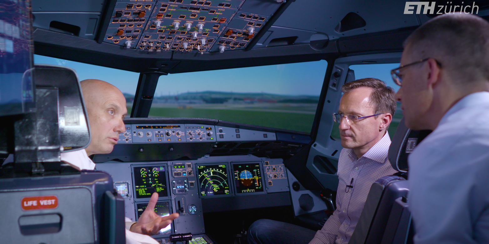
August 2020
Pilots not only have to make the right decisions, but they have to do it quickly and process a lot of information - especially visual information. In a unique project, ETH Zurich and Swiss International Air Lines have investigated what the eyes of pilots do in this process.
Martin Raubal, Professor of Geoinformation Engineering at ETH Zurich, appreciates the practical relevance of this research collaboration, which could contribute to increasing flight safety. Anyone who wants to develop it further should take off their blinders and think outside the box, says Christoph Ammann, captain and instructor at Swiss. And ETH Zurich is an ideal partner for this.
external pageWorshop talk (in German)
EDC Student of the Year Award
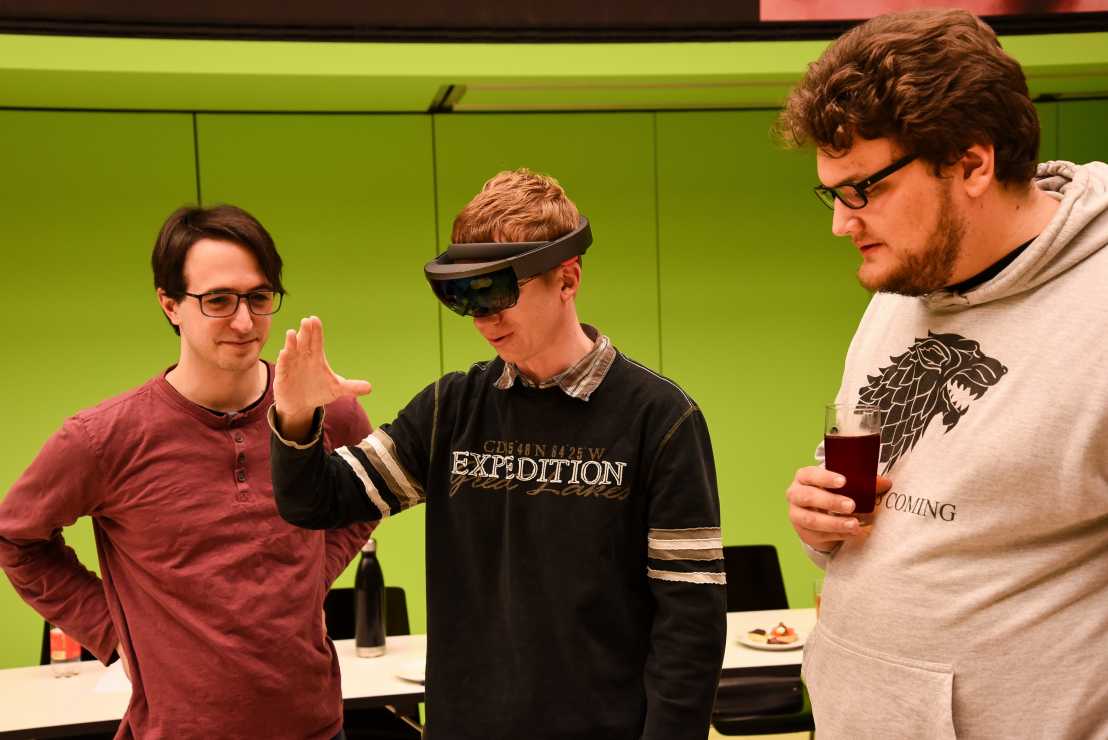
June 2020
We congratulate Emanuel Meier and Konstantin Arbogast on winning the Esri EDC Student of the Year Award 2020! Within the GIS and Geoinformatics Lab in Autumn Semester 2019 the two Master students developed a mixed reality app called external pageProject Lelantos for the Hololens© which imitates and augments the famous board game „Scotland Yard“.
They designed the game for Zurich and implemented famous buildings and streets with the CityEngine from Esri. In multiuser mode, up to three users playing detectives can chase Mister X throughout the city. In addition to the tactical game strategy, the game also allows them to get to know Zurich better.
Moving into the future with real-time and predictive traffic management

February 2020
HERE Technologies, named number one location platform this year by Strategy Analytics, focusses on stepping beyond maps to building a digital representation of reality. This can be helpful in a number of ways like for real-time and predictive traffic management, which can contribute to making the mobility system more energy efficient. In an external pageinterview, David Jonietz, former PostDoc scientist in the SCCER Mobility network, shares his experience in switching from academia to being a research group leader at HERE Technologies. Along with David Kreil, one of the founding directors, he also talks about the newly established Institute of Advanced Research in Artificial Intelligence (IARAI).
Research Kick-off of Future Resilient Systems II programme
April 2020
The second phase of the FRS programme at the Singapore-ETH Centre officially started in April 2020 with an online research kick-off meeting. It was launched in the midst of a global crisis - COVID-19, highlighting the need to better understand and foster resilience. Within FRS-II there is a particular emphasis on social resilience to enhance the understanding of how socio-technical systems perform before, during and after disruptions. Martin Raubal is leading the Cluster on Distributed Cognition Enabled by Data Science in this 5-year programme, which focuses on extracting knowledge from multi-layer networks and big data to enhance sense-making and improve social and socio-technical resilience. Researchers from our geoinformation engineering group will work on developing a methodology and prototype for detecting weak signals in spatio-temporal data to identify potential disruptions. This includes investigating the impact of context for analyzing mobility data and optimizing strategies for communicating predicted disruptions to stakeholders.
Final project event – Enhanced flight training program for monitoring aircraft automation
December 2019
On the 25th of November we presented the final results of our project entitled: “Enhanced flight training program for monitoring aircraft automation“.
The project was partially funded by the Swiss Federal Office of Civil Aviation (external pageBAZL), was led by external pageSWISS International Airlines Ltd., and supported by Prof. Dr. Robert Mauro from the external pageDepartment of Psychology (University of Oregon) and Dr. Immanuel Barshi from external pageNASA Ames Research Center, Human Systems Integration Division (NASA).
As part of this very successful project we developed a system that provides instructors with more detailed insights concerning pilots’ attention during training flights, to specifically improve instructors’ assessment of pilot situation awareness.
Our project has recently been featured in different media. ETH News has published a thorough article on our project (Tracking the eye of the pilot), and different articles have been referencing this publication. Additionally, there have been two radio interviews with Prof. Dr. Martin Raubal at external pageRadio Zürisee and SRF4 (both in German).
Tracking the eye of the pilot
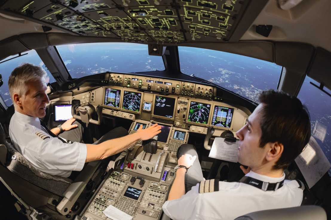
November 2019
The project external pageEnhanced flight training programs for monitoring aircraft automation, which started in 2015, concluded with a successful presentation of the results on 25. November 2019. More information on the project and its goals can be found in the recently published ETHZ News.
Successful GISDay
November 2019
The “Tag der Geomatik” is the GISDay of the University of Applied Sciences and Arts Northwestern Switzerland (FHNW) and ETH Zurich and gives insight into the versatility of the field of geoinformatics and surveying. This year's event took place as part of the external page200yrs Swiss Geo X events at the Culture and Convention Centre in Aarau and was held under the motto: how is our habitat recorded, what do we learn from the spatial data obtained and how do these data enable the sustainable design of our future habitat. One module also addressed the question whether we will lose spatial orientation in the future if we completely outsource navigation to a computer system and give up personal perception of space. This module with the ETH-App external pageOMLETH took place outside in the old town of Aarau and provided GPS-based tricky exercises for spatial perception and orientation. Back in the congress centre the results were evaluated, visualised and discussed with the participants. A great event with a glittering feedback wall in the thumbs-up area.
Prix Carto - Edu
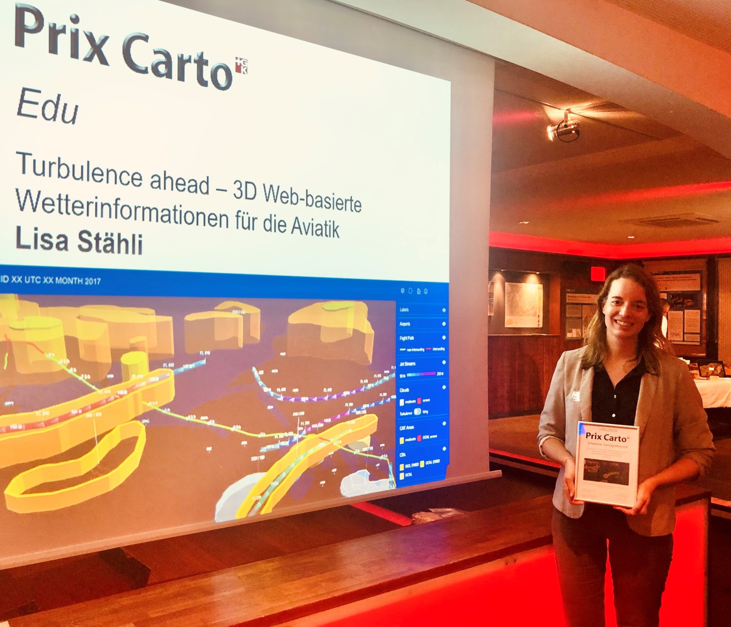
October 2019
We cordially congratulate our former master student Lisa Stähli on winning another award - the external pagePrix Carto Edu.
This prize is awarded to students in training by the Swiss Society for Cartography (SGK) every second year. The award honors outstanding and innovative cartographic works related to Switzerland and makes them known to a wider public. DownloadLaudatio (in German)
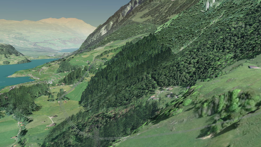
What is a valley?
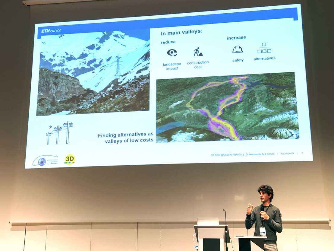
October 2019
We are glad that our Master student Daniele Moncecchi was selected among the finalists of the best poster competition at the SCCER FURIES conference 2019 and could present the approach of his thesis to a broad audience! In his thesis “What is a valley?” he investigates, how the automatic determination of mountain ridges and valleys could be used to improve power transmission line planning.
More information on the project 3D Decision Support System can be found on its Website
Invited Talk by Sophie Stellmach on Mixed Reality
September 2019
The external pageGeoGazeLab is glad to announce an invited talk by Sophie Stellmach on Eye Tracking and Mixed Reality as part of the VERA Geomatics Seminar.
Dr. Sophie Stellmach is a Senior Scientist at Microsoft where she explores entirely new ways to engage with and blend our virtual and physical realities in products such as Microsoft HoloLens. Being an avid eye tracking researcher for over a decade, she was heavily involved in the development of gaze-based interaction with HoloLens 2.
The talk will take place as part of the VERA Geomatics Seminar on Thursday, 10th October 2019, 5:00 p.m. at ETH Hönggerberg, HIL D 53.
Title: DownloadMultimodal Gaze-supported Input in Mixed Reality and its Promises for Spatial Research
GIS Group at Scientifica 2019
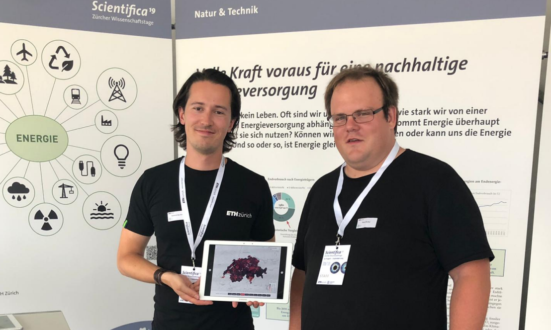
September 2019
Members of the GIS Group presented the results of a recent publication to a larger public during the recent exhebition external pageScientifica.
With the Energy Strategy 2050, Switzerland committed to reduce greenhouse gas emission by 43% until the year 2035. Currently, the transport sector is the only sector without a decrease in energy consumption. In our recent publication, we analyzed the energy and greenhouse gas reduction potentials when electric bikes are used instead of internal combustion engine cars for commuting. Our analysis includes different scenarios for minimal temperature acceptable to take the electric bike, precipitation as well as maximal trip duration. The results show that energy reductions between 10% and 17.5% are possible.
If you are interested in the saving potentials of your municipality, please click the following link:
external pagehttps://mie-lab.github.io/commuter-ebikes-ch
PEGGASUS in the news
July 2019
Our research project PEGGASUS (Pilot Eye Gaze and Gesture tracking for Avionics Systems using Unobtrusive Solutions) has attracted quite a bit of coverage in the media.
See for yourself in this little press review:
“external pageJetzt kommt der Robo-Copilot” on higgs magazine (article, German)
“external pageLe CSEM coordonne un projet européen d’assistance aux pilotes d’avion” on Radio Télévision Suisse (radio broadcast – click on image for audio, French)
“external pageEnsuring harmonious human–machine collaboration in the cockpit” in Eurotec magazine (arcticle, English)
“external pageHand in Hand im Cockpit” in Aktuelle Technik (article, German)
“external pageMensch-Maschine-Schnittstelle im Cockpit” in Digital Engineering Magazine (article, German)
Honor for René Buffat
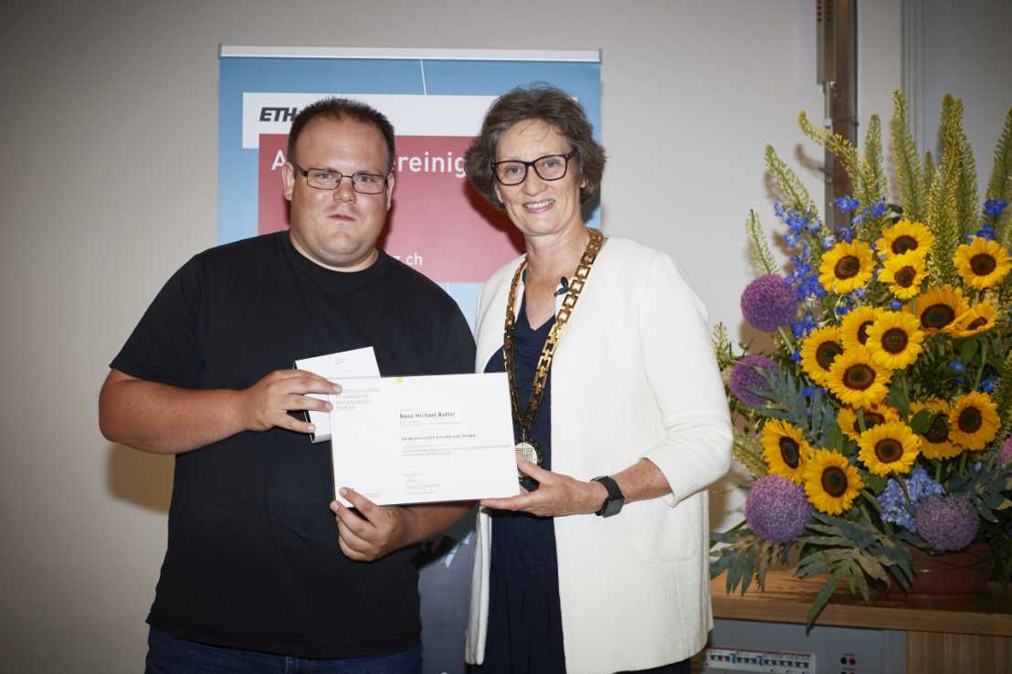
July 2019
René Buffats outstanding doctoral thesis on Spatio-Temporal Modelling of a Biogenic Combined Heat and Power Plant Swarm for Switzerland was honoured with the Silver Medal of ETH Zurich. The certificate together with a financial sum was awarded in a ceremony beginning of July by the Rector of ETH Zurich, Professor Dr. Sarah Springman
We congratulate him on winning this prize!
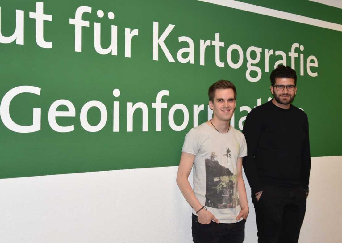
Open Data Student Award
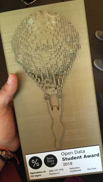
July 2019
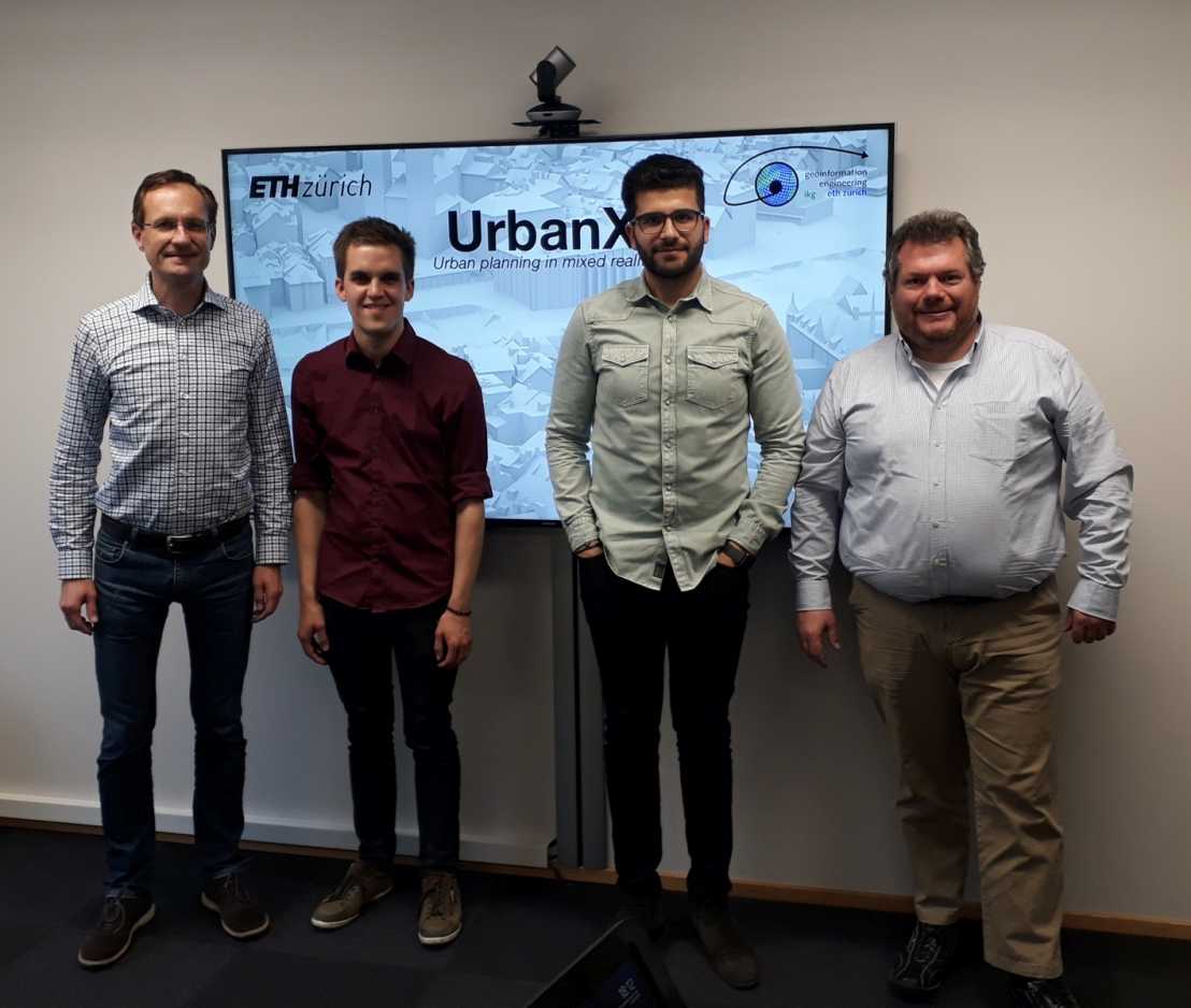
We congratulate Daniel Laumer and Hasret Gümgümcü on winning the Student Award 2019 offered by external pageOpendata.ch. Their project external pageUrbanX using Hololens for planning purposes was developed during the GIS & Geoinformatics Lab at our chair and convinced the jury.
Future mobility
June 2019
Today so and tomorrow differently. Combining mobility and mixing means of transport is very much in vogue. We met Martin Raubal, Professor of Geoinformation Engineering at ETH Zurich. He answered our questions about the trends in mobility. You can read the whole external pageinterview on "Basel en route" (in German only).
Impressions from ET4S
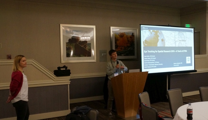
June 2019
Our group has organized the “Eye Tracking for Spatial Research” event as a track at this year’s external pageETRA conference in Denver, Colorado. It featured four full paper presentations, one short paper presentation, as well as an invited talk (see program). A dominant topic at this year’s ET4S was augmented/mixed/virtual reality. As a particular highlight, our invited speaker Sophie Stellmach (Senior Scientist at Microsoft) highlighted the fascinating opportunities of HoloLens 2, an upcoming mixed reality device that will have eye tracking capabilities included.
The GeoGazeLab was further involved with Fabian Göbels talk on “external pagePOI-Track: Improving Map-Based Planning with Implicit POI Tracking” and Kuno Kurzhals presenting his work on “external pageSpace-Time Volume Visualization of Gaze and Stimulus” in the ETRA main program. A paper co-authored by Martin Raubal was presented by one of his co-authors (“external pageEye Tracking Support for Visual Analytics Systems: Foundations, Current Applications, and Research Challenges”).
Winners of the Esri Switzerland Young Scholar Award 2019
May 2019
We are very happy to announce that Hasret Gümgümcü and Daniel Laumer won this year's Esri Switzerland Young Scholar Award with their application external pageUrbanX developed during the GIS Lab. The prize - an invitation to join the worlds biggest GIS conference in San Diego - was handed over during a ceremony at Esri Switzerland in Zurich!
Retreat of GIS-Group
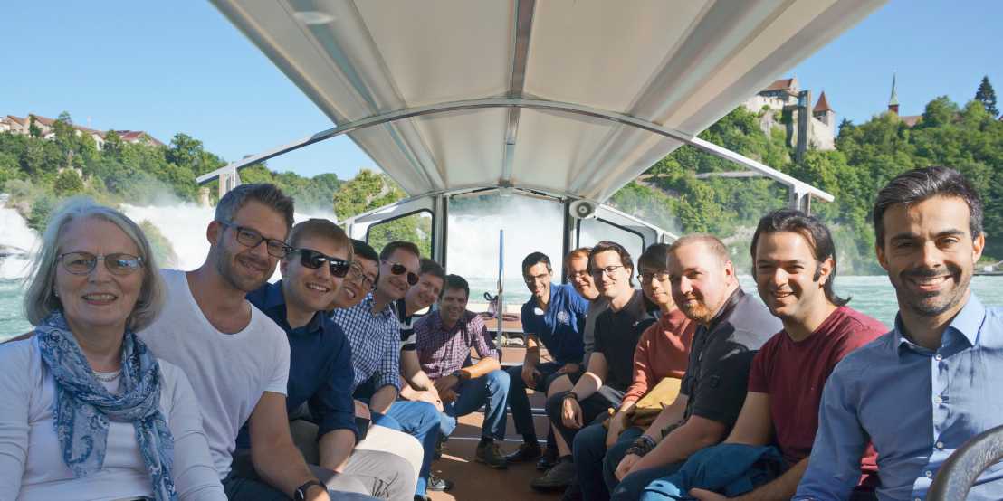
June 2019
This year's retreat of the GIS Group was held in external pageMusikinsel Rheinau - a former monastery. During our stay not only new research topics were discussed and current results presented - there was also enough time for informal talks. A highlight in best summer weather was a visit of the Rhine Fall which actually carries a lot of water, and the boat trip back to Rheinau.
ETIZ Meeting
March 2019
The external pageGeoGazeLab of our Chair hosted a meeting of the Eye Tracking Interest Group Zurich (ETIZ) on 26 March 2019 with more than 35 participants. The two presentation on Pervasive Eye Tracking (external pageProf. Dr. Andreas Bulling, University of Stuttgart) and gaze-based interaction with panoramas (Tiffany Kwok, GeoGazeLab, ETH Zurich), as well as an interactive mini-workshop on Eye Tracking in VR/AR (external pageDr. Arzu Çöltekin, FHNW), stimulated discussions. During a following apéro, participants could take the opportunity to network and to try out a gaze-based interactive map demo.
Student Project UrbanX Won Two Awards
UrbanX - Urban planning in mixed reality
March 2019
For the first time we have awarded a team - Hasret Gümgümcü and Daniel Laumer - for the Esri Student of the Year Award 2019. They further won the Esri Switzerland Young Scholar Award and have been invited to present their project on the Esri International User Conference in San Diego, California. Both worked on their project in our GIS and Geoinformatics Lab.
The goal of this project was to develop a Hololens application to do urban planning in a mixed reality environment and provide a framework which makes the process more efficient and immersive. The Microsoft Hololens is a recently developed pair of head-mounted mixed reality smartglasses, which lets the user place virtual holograms in the real world and interact with them using specific gestures. The application displays the buildings in the region of interest and let the user access the attributes of each object in an easy and intuitive way. Editing functionalities allow the user to freely make changes to the model. They produced both an informative Video and Website.
Pilot Eye Gaze and Gesture tracking for Avionics Systems using Unobtrusive Solutions (PEGGASUS)
January 2019
external pagePEGGASUS will create the first cockpit based crew monitoring system for enhanced flight safety, improved workload management and better crew awareness. To realize this goal we have brought together leading innovation technology companies, world class research institutes and key avionics experts.
The project will go beyond state-of-the-art artificial intelligence algorithms, that will be tailored with data collected from a dedicated vision system. Initial focus will be on flight safety and pilot comfort through eye-gaze analysis and hand gestures.
Our collaborators are: SERMA Ingenierie, csem, Swiss International Airlines, Thales
This project has received funding from the Clean Sky 2 Joint Undertaking under the European Union’s Horizon 2020 research and innovation program under grant agreement No. 821461
Paving the way for smart mobility
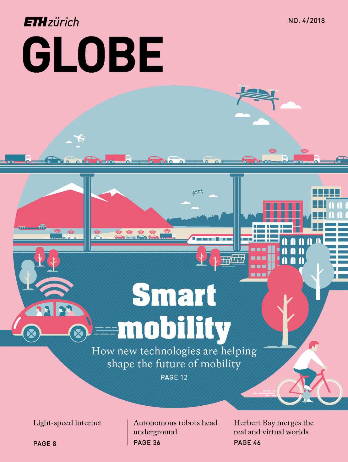
December 2018
An article featuring our research has been published in the newest issue of ETH Globe.
Modern IT solutions not only give us a better understanding of human mobility behaviour – they also help improve environmental performance
and enable intelligent demand management. DownloadLink to article (PDF, 108 KB).
Out of the lecture hall
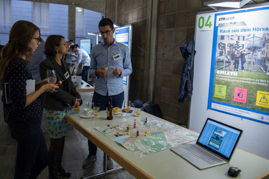
November 2018
The external pageOMLETH platform helps lecturers to plan and implement outdoor learning courses. It is one of 25 projects to be presented at the first Learning and Teaching Fair at ETH Zurich. The project itself is presented to a broader public on the ETH Newspage.
Best Poster Award
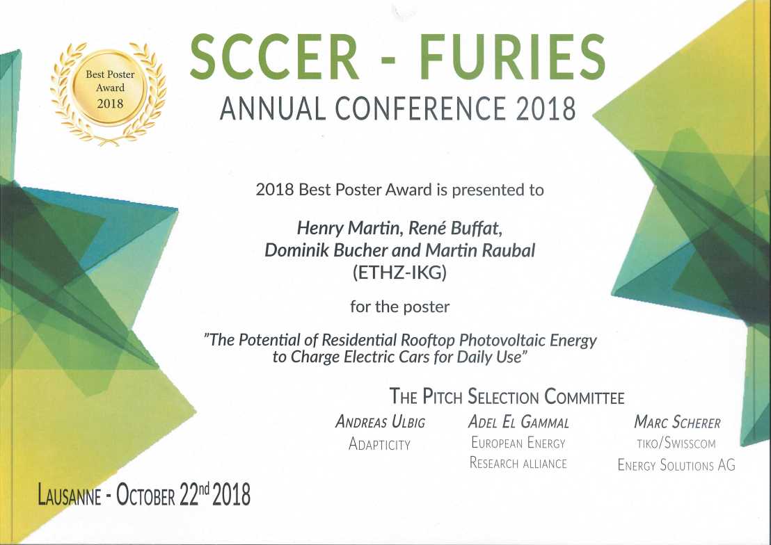
Oktober 2018
Congratulations to Henry Martin, René Buffat, Dominik Bucher und Martin Raubal for winning the 2018 Best Poster Award at the annual external pageSCCER-FURIES Conference in Lausanne!
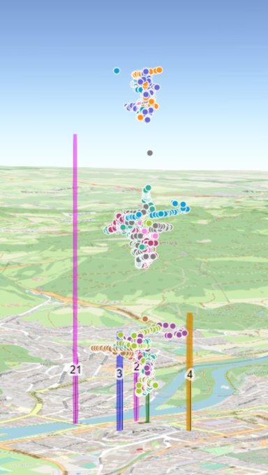
Lisa Stähli wins SWISSED18 prize
September 2018
We are happy to announce that our Master student Lisa Stähli won the student prize at the Swiss Society of Systems Engineering Day (external pageSWISSED) 2018 for her master thesis Turbulence ahead – Using JavaScript to Design a Web-based 3D Turbulence Simulator.
ET4S 2019 - Call for Papers

October 2018
After the success of the preceding editions, we will again be organizing the event Eye Tracking for Spatial Research (ET4S) in 2019. ET4S brings together researchers from different areas who have a common interest in using eye tracking for research questions related to spatial information and spatial decision making.
Unlike the preceding years, ET4S 2019 will no longer be organized as a workshop, but as a track at the conference external pageACM 2019 Symposium on Eye Tracking Research & Applications (ETRA), which will take place June 25-28, 2019 in Denver, Colorado, USA.
The Call for Papers is now available. Deadline for abstracts: 14 Dec 2018. Deadline for full papers: 19 Dec 2018.
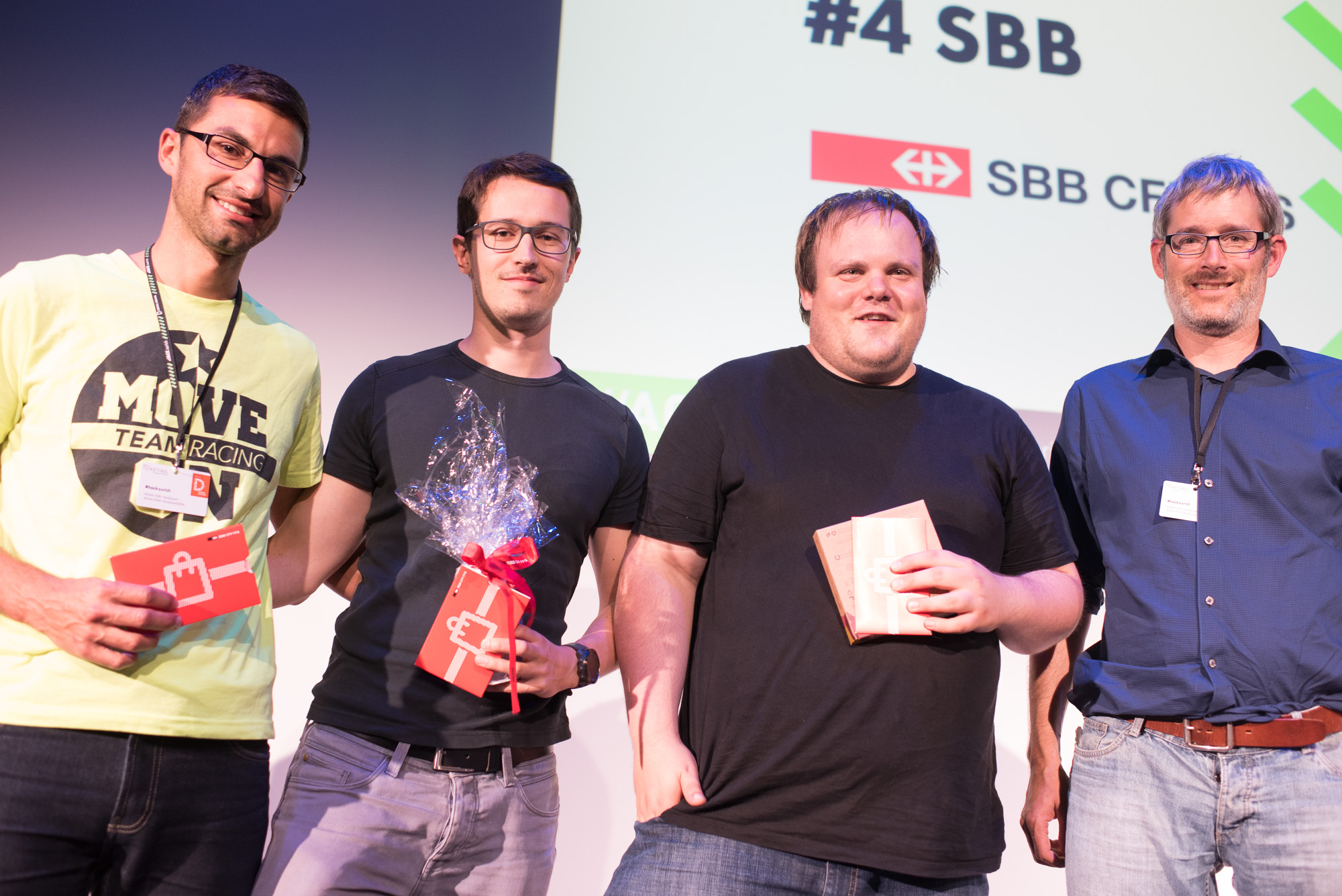
Hack Zurich 2018
September 2018
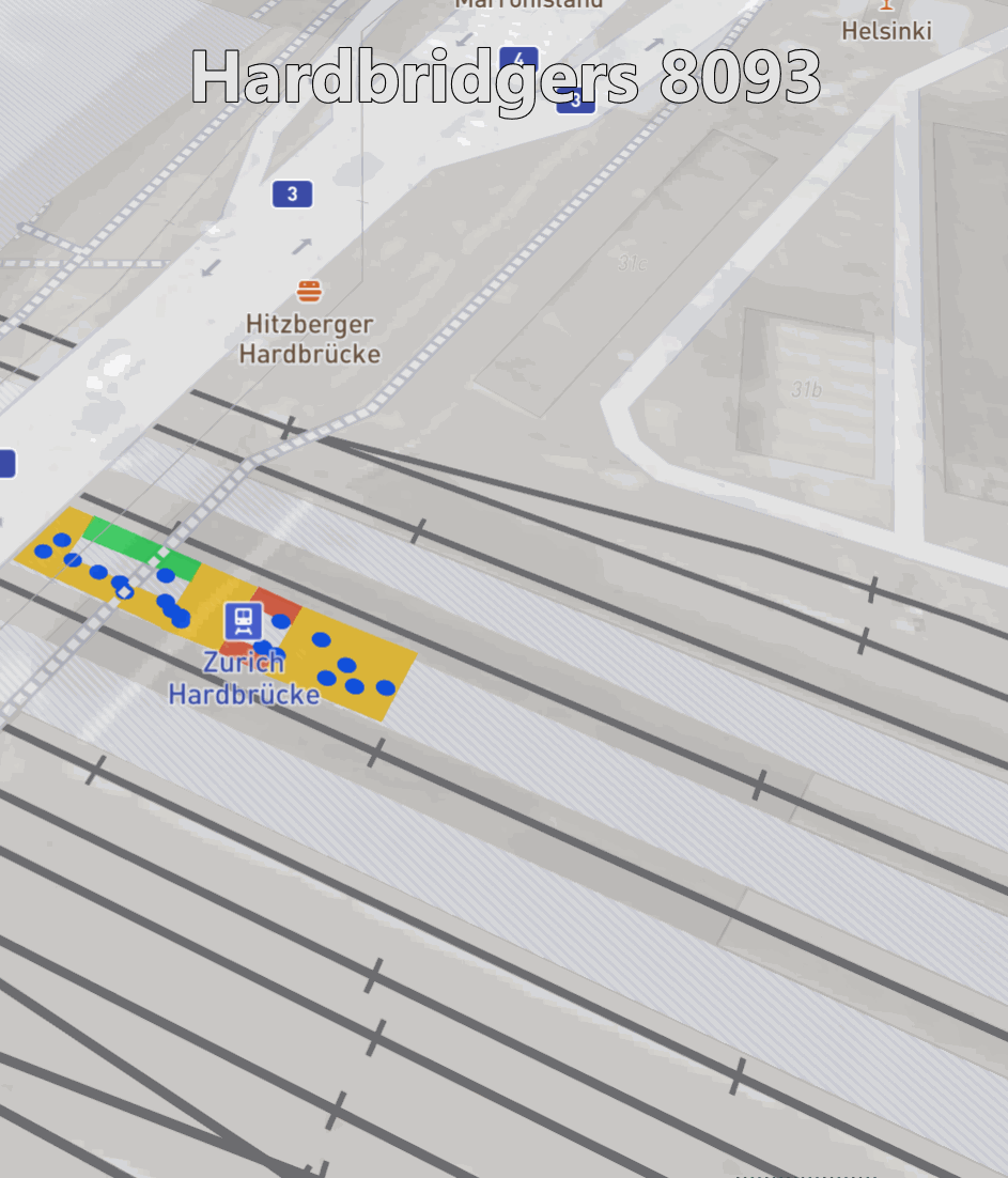
Members of the Geoinformation Engineering Group successfully participated at this years external pageHack Zurich event and won with their application the price donated by Siemens.
The train station Hardbrücke suffers from small platforms which create dangerous situations when trains arrive with high speeds at the station during rush hours. The wide availability of sensor data and the new technological advances in automated movement tracking and analysis allow us to prevent the formation of human crowds in dangerous areas. An app tracks people via Bluetooth beacons, and gets supplemented by human movement data from various sources: a) video tracking and AI analysis, b) counter at staircases, c) real-time train tracking. We integrate this data and use advanced algorithms for smart traffic shaping. Crowded places are highlighted using LED strips mounted on the platforms. Moving to less crowded areas is encouraged with a discount on the train ticket. This discount is automatically integrated into the SBB and Siemens pay-as-you-ride ticketing system.
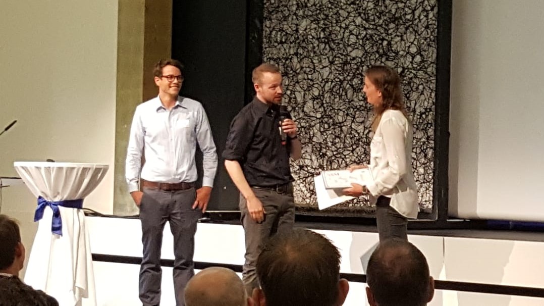
Congratulations to DownloadFabian Göbel, Dominik Bucher, Henry Martin and David Rudi (JPEG, 156 KB)!
ETH Industry Day
September 2018
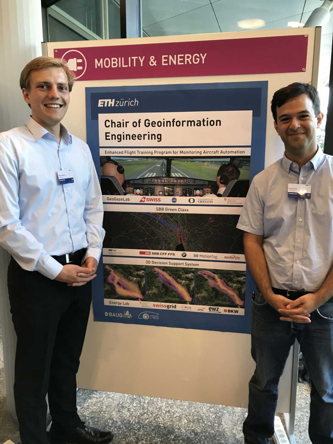
The Chair of Geoinformation Engineering was present at this years ETH Industry Day and could profit of many contacts with representatives of various industries regarding future research collaborations. external pageProf. Dr. Martin Raubal gave an overview on the main topics the tree groups at his chair are focusing on: external pageEye-Tracking, Mobility Information Engineering and Renewable Energies.
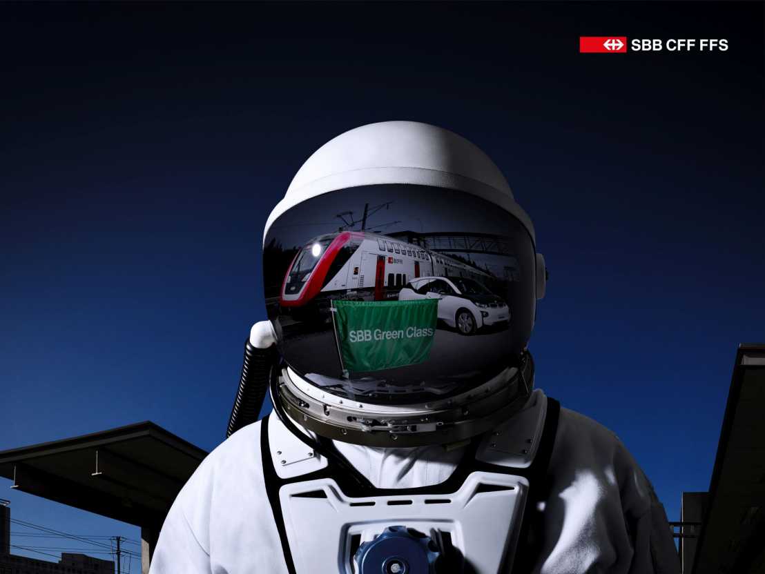
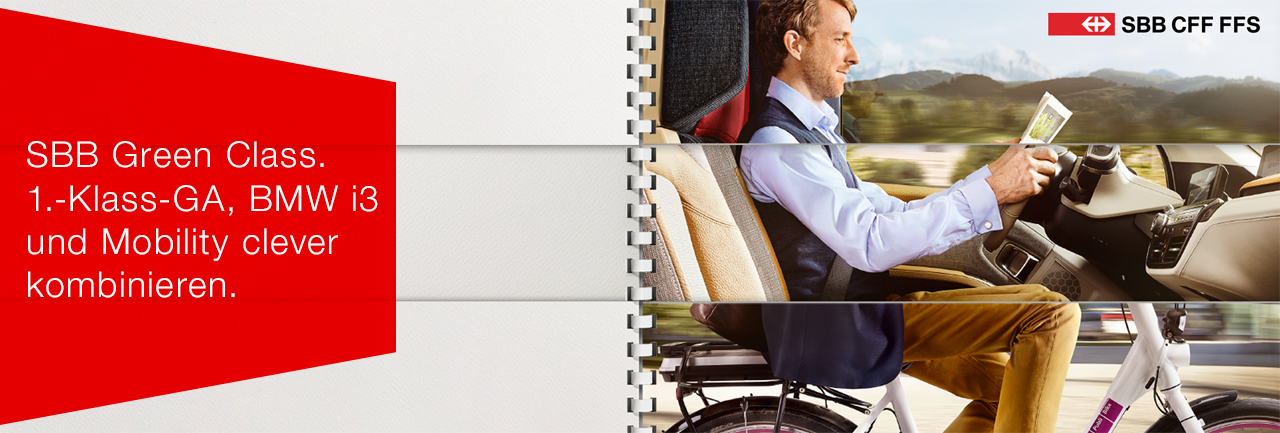
SBB Green Class
September 2018
SBB presented their Green Class mobility services for road and rail in a single package from one supplier opening up completely new ways for you to enjoy sustainable door-to-door mobility to the public. Since the launch of the Mobility subscription in spring 2018 SBB added the new Tesla Model S, the new Nissan Leaf and the VW e-Golf to its fleet of cars.
The Geoinformation Engineering Group lead by Prof. Dr. Martin Raubal at ETH Zürich is a scientific partner since the pilot phase of external pageSBB Greem Class.
Planning power transmission lines in 3D – extension on for earth cables
June 2018
ETH Zurich is actively contributing to the European energy transition. Although new power transmission lines are needed required to connect renewable energy plants with the consumer market, the exact location for such a corridor is a matter of negotiation. Therefore, our research group (in collaboration with the Chair of Planning of Landscape and Urban Systems (PLUS)) developed a system that supports decision-makers in finding a corridor alternative that satisfies the needs of all people involved in the planning project. Our system is easy to handle, quickly computes the optimal transmission line path, and visualizes it in 3D. Several media reported about our 3D Decision Support System and its usefulness in practice:
- BFE: Energy research and innovation – external pageReport 2017
- BFE: energeia plus (German) – external pageWie VR die Planung von Stromleitungen beeinflusst
- RGI: external pageNominee for the Good Practice of the Year Award 2018
As experts from the Swiss Federal Office of Energy SFOE approved the usefulness of our 3D Decision Support System, the project will extend its focus on earth cables. We look forward to working with the SFOE, Swissgrid, Elia, and ewz.
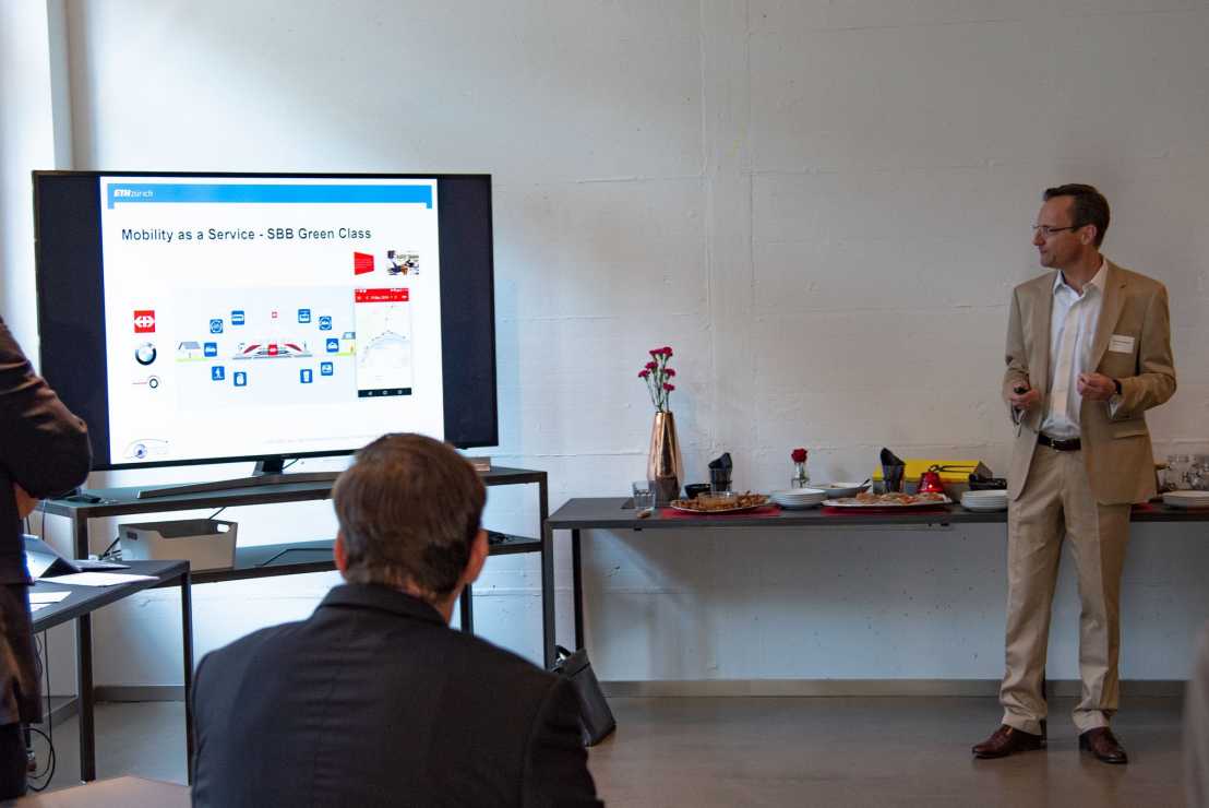
Capturing usage patterns of a comprehensive Mobility-as-a-Service offer with GPS-tracking – First results from the SBB Green Class project
June 2018
In 2017, the Swiss Federal Railways (SBB CFF FFS) launched the SBB Green Class project, a one-year pilot study in which 140 participants across Switzerland were offered a comprehensive Mobility-as-a-Service (MaaS) package, containing (among others) a general public transport pass valid in the entire country (GA) and an electric car (BMW i3). In order to assess the customers’ reactions to this unprecedented offer, the participants were tracked with a smartphone application for the entire project duration. The resulting data were processed and analyzed by the Mobility Information Engineering (MIE) Lab at the Chair of Geoinformation Engineering, ETH Zurich, with a particular focus on assessing the potential of such mobility packages for inducing more sustainable transportation behavior. Article
From Location Tracking to Personalized Eco-Feedback: Results from the GoEco! Study
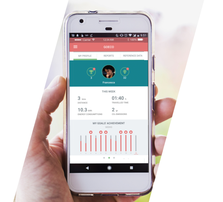
May 23, 2018
Todays modern smartphones are not only widely used, but also often equipped with GPS receivers and other sensors to allow constant monitoring of their users’ locations and in some cases even recognition of their activities. For this reason, these mobile devices are of particular interest for transport and mobility, where detailed movement data are needed not only for urban planning and smart city-related activities, but can also be of use for providing individual users with feedback and suggestions for personal behavior change. external pageFull article
ETH News for Industry video on "Awareness in Aviation" project
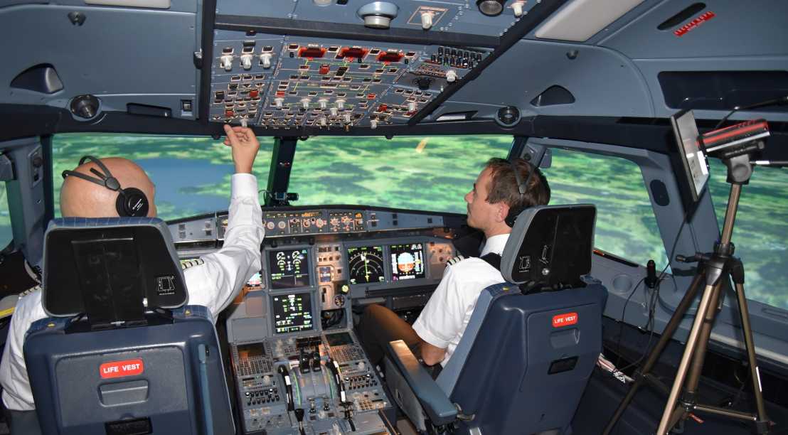
April 2018
ETH News for Industry asked themselves: What is the best strategy for pilots to monitor instruments in modern aircrafts? Researchers from ETH Zurich work together with Swiss International Air Lines to develop an instructor assistant system for the training of pilots. external pageWatch the video
New SBB Green Class Mobility Package
April 2018
SBB (Swiss Railway) presents the new SBB Green Class Mobility Package where different sustainable means of transportation and services for road and railway are combined.
More informationen on the project external pageSBB Green Class.
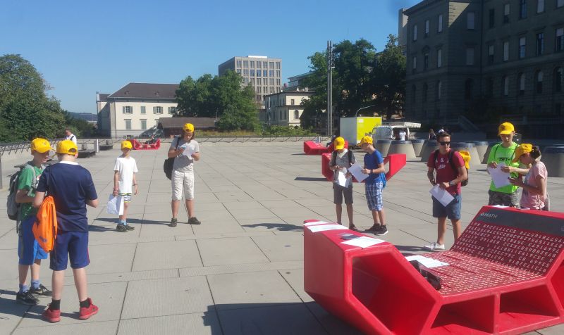
Treffpunkt Science City
March 2018
The LAMETTA project has been demoed at this year’s “Treffpunkt Science City” event, an educational program of ETH Zurich for the general public where on total more than 3,000 visitors came.
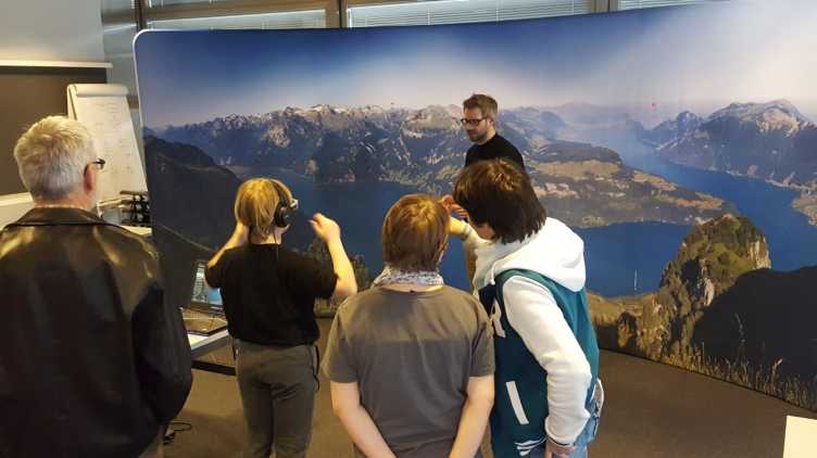
Our panorama wall installation and the LAMETTA software allowed our visitors to experience as if they were exploring the view from a vantage point. Just by looking at the interested area (such as lakes, mountains and villages), our system can provide related information to the user. Visit our external pageGeoGazeLab Site.
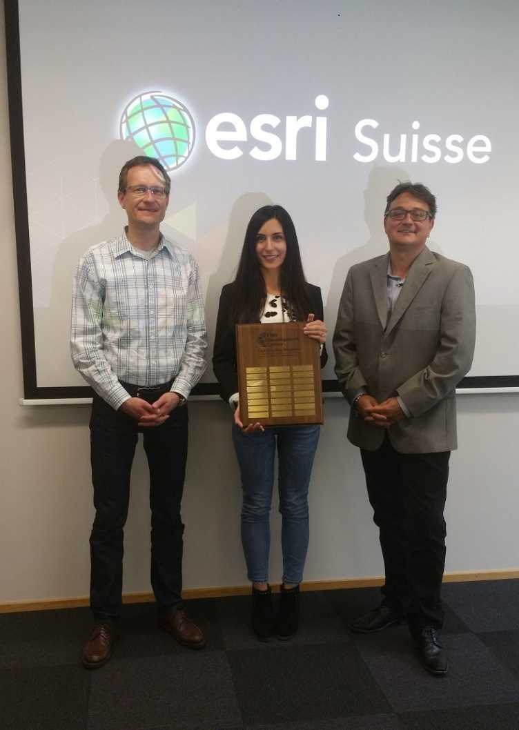
Esri Student of the Year Award 2018

March 2018
Jorim Urner won the EDC Student of the Year Switzerland award for his master’s thesis titled “Incorporating Spatio-Temporal Context for Predicting the Next Place Using Neural Networks and Random Forests” and his contributions to the GoEco! project. In his work he looked at ways to predict the places where GoEco! participants travel in the future, based on a variety of contextual factors such as the day of the week, or recurring travel patterns.
Nadine Piveteau wins award in geoinformatics
March 2018
We congratulate Nadine Piveteau on winning the promotional award in geoinformation at the PFGK conference 2018 for her outstanding Master’s thesis entitled "A Novel Approach to the Routing Problem of Overhead Transmission Lines"! We are delighted by the successful collaboration and by the recognition of her achievements by the expert jury of Runder Tisch GIS e.V.
external pageNewsletter Runder Tisch GIS e.V. / external pageMore Informationen (both in German only)
Call for Papers: Spatial Big Data and Machine Learning in GIScience

March 2018
Together with colleagues from the University of Illinois at Urbana-Champaign, we are organizing a workshop on “Spatial Big Data and Machine Learning in GIScience” at this year’s external pageGIScience conference in Melbourne, Australia.
If you are interested in the process of generating knowledge from large spatial datasets, please note the 1st Call for Papers on the workshop website.
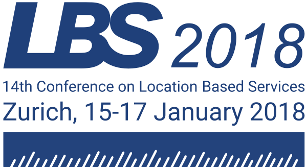
Successful LBS conference 2018 in Zurich
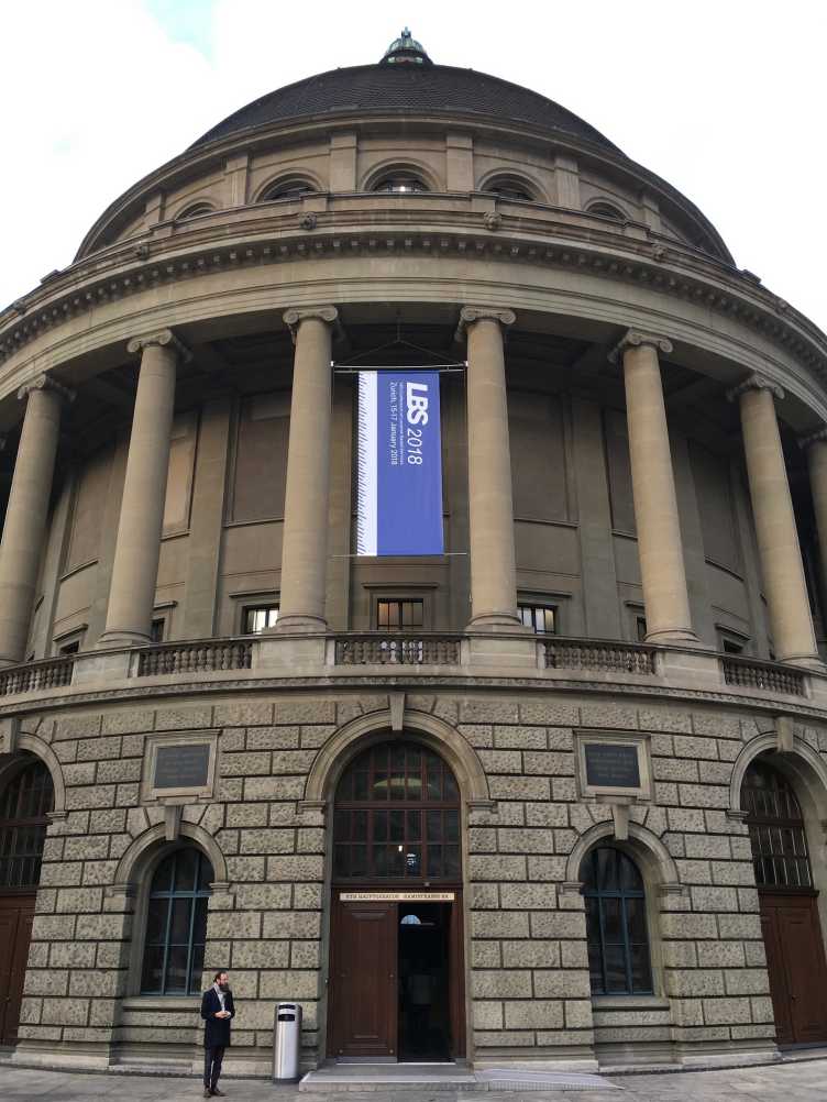
January 2018
Between 15 and 17 January, the 14th International Conference on Location Based Services (LBS 2018), organized by our group, was taking place in Zurich. A total of over 120 international participants exchanged ideas about current research activities and the development of the field of location based services (impressions).
Highlights of the program were, among others, the two keynote presentations given by Johannes Schöning (University of Bremen) and Mike Gould (Esri Inc. and Universitat Jauma I).
We’d like to thank Esri Switzerland, Esri Inc., the department D-BAUG of ETH Zurich, as well as city and canton of Zurich for their support.
OMLETH at Innovedum Event 2017
November 2017
The annual Innovedum event on November 23 at the Semper Aula was an opportunity for informal discussion among the Innovedum project leaders, departmental Educational Developers, and students. Around 150 participants attended the event. The Rector gave the welcome speech and presented certificates to the students for their efforts on behalf of Student Innovedum. The event’s highlight was the short presentation of three Innovedum projects under which OMLETH was shown. Martin Raubal and Christian Sailer presented the project and showed the brand new OMLETH explainer external pagevideo (only in German), which received much positive feedback and interesting discussions at the aperitif.
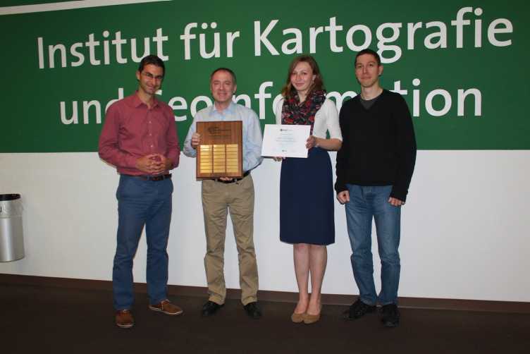
Best Poster Award 2017
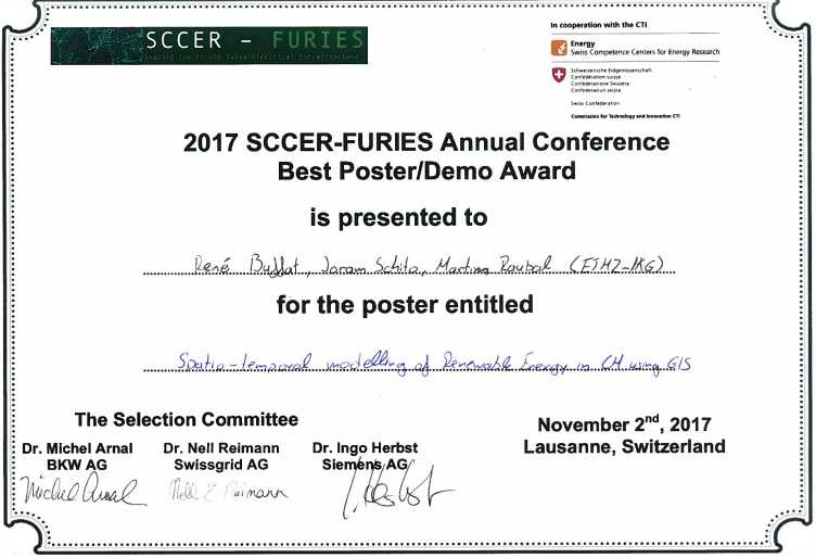
November 2017
We are happy to announce that our contribution “Spatio-temporal modelling of renewable energy in Switzerland using GIS”, authored by René Buffat, Joram Schito, and Martin Raubal, was elected best poster at the SCCER FURIES Annual Conference 2017 in Lausanne, Switzerland! DownloadPoster (PDF, 3 MB)
LBS Conference 2018 in Zurich: Call for Participation
November 2017
The 14th International Conference on Location Based Services (LBS 2018), organized by our group, is approaching. A registration for the conference for the reduced (early bird) price is possible until 28 November.
The most important parts of the program are now fixed and provide an outlook on the conference in January: the list of accepted papers, the keynote presentations, as well as icebreaker apéro and conference dinner.
If you’d like to present your research at LBS 2018 on short notice, you can still submit a showcase proposal until 15 November.
Exciting findings from the collected mobility data from SBB Green Class
September 2017
In this external pageinterview Thomas Hettinger (Customer Insights & Analytics ati SBB) and Prof. Dr. Martin Raubal (ETH Zurich) give interesting insights into the newly launched «SBB DailyTracks» App (in German only).
GeoGazeLab at Scientifica 2017
August 2017
We’re excited to present the external pageLAMETTA project at external pageScientifica, the science fair of ETH Zurich and University of Zurich. Come and try out an interactive mobile eye tracking system! Explore a mountain panorama and interact with it only by using your gaze (external pagedetails in German)!
You can find us Friday, 1 September to Sunday, 3 September at external pageUniversity of Zurich main building (West Foyer).
Check out our external pageScientifica video!
PhD Position at GeoGazeLab
July 2017
We are offering a PhD Position at the external pageGeoGazeLab at the Chair of Geoinformation Engineering and are looking forward to your application!
Esri EDC Student of the year award 2016
July 2017
In 2016 Lisa Stähli received the EDC student of the year award for her outstanding interdisciplinary project work entitled: Pedestrian Navigation in a Virtual Urban Environment: Evaluation of wayfinding directions indicated on public displays.
Esri Young Scholar Switzerland of the Year
Simon Haumann was selected as Esri young scholar Switzerland with his Master thesis: Optimizing the Operation Range of E-Bikes in Routing Systems.
They were both invited to attend the 2017 Esri Education GIS Conference and Esri User Conference in San Diego, July 8-14
external pageEsri EDC Student of the year: Lisa Stähli
external pageEsri Young Scholar Switzerland: Simon Haumann
Best Short Paper Award
May 2017
We are happy to announce that our contribution “Energy-based Routing and Cruising Range Estimation for Electric Bicycles”, authored by Simon Haumann, Dominik Bucher und David Jonietz, was elected best short paper at AGILE 2017 conference in Wageningen, The Netherlands! external pageWebpage
3D GIS for planning electric power systems
May 2017
The journal ENERGEIA of the Swiss Federal Office of Energy SFOE has published the article "Planen mit 3D-Software" in the latest issue 3/2017. The article describes the current research project and provides an outlook over future issues in this research field. external pageArticle
Furthermore, the article "3D GIS for planning electric power systems” by Prof. Dr. Martin Raubal and Joram Schito from our group has been published on the weekly spotlight on Energy Research. Article
New PhD Position at MIE-Lab
May 2017
We are offering a new PhD Position at the MIE-Lab (Mobility Information Engineering Lab) at the Chair of Geoinformation Engineering and are looking forward to your application!
New tool from ETH Zurich assists in transmission line planning
April 2017
The new tool provides a bird's-eye view of high-voltage transmission lines, as well as from the pedestrian's perspective.
Planning high voltage transmission lines is a great challenge. Where will the new line run? Not an easy question. Especially if it runs close to residential areas or through nature and landscape protection zones. Decision support systems not only simplify the planning of new high voltage transmission lines, but also help to illustrate possible solutions faster.
ETH Zurich is developing such a system in collaboration with external pageSwissgrid and other partners. Apart from statutory planning conditions, the system also employs geographic data for its calculations. Users of the tool first define how suitable certain landscape types are for the construction of a transmissoin line, in terms of planning, technical and environmental issues. The software then selects the optimum corridor between the start and end points in each case.
The new tool provides a bird's-eye view of high-voltage transmission lines, as well as from the pedestrian's perspective. The tool enables the illustration of various solutions which reflect the interests of the parties involved. Swissgrid will use the tool on completion (expected in the autumn of 2017) to assist in the planning of transmission lines. The new instrument has great potential to make the planning of transmissoin lines more transparent and efficient.
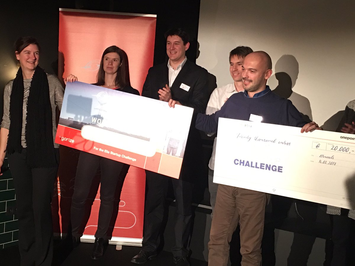
ENSIPLAN wins Elia's first Startup Challenge
February 2017
Stefano Grassi won the first prize of an international competition for startups promoted by Elia Group aimed at finding a solution to improve the public acceptance of electricity infrastructures. The Elia Group is organized around two electricity transmission system operators (TSOs): Elia Transmission in Belgium and 50Hertz Transmission, one of the four German TSOs, active in the north and east of Germany. The startup ENSIPLAN won the competition against other 30 startups and received a €20,000 prize to realize its proposal with ELIA Group in the next months. ENSIPLAN provides a 3D visualization tool combined with a planning process for power lines enabling engineers and stakeholders involved in the planning process to have a realistic experience and perspective of the visual impact of a power line in the landscape and to interactively participate in the planning process. The developed tool is conceived and designed to support the planning and visualization of any type of linear infrastructures such as roads, power lines, railways and lifts. Aim of the startup is to target also the wind and solar energy market where the development of new project is often opposed by local population concerned by the visual impact of such large infrastructure. With this solution, ENSIPLAN provides project developers with an instrument for increasing the public participation and to enhance the communication during the planning process. The project is the follow up of research project funded by Ministry of Energy of Switzerland, Swissgrid, APG (national power grid operator in Austria) and BKW.
LBS Conference 2018 in Zurich: Call for Papers
March 2017
We are organizing the 14th International Conference on Location Based Services, 15-17 January 2018 in Zurich. The LBS conference is targeted at researchers and practitioners whose work is either focused on or relevant to location based services (LBS). The conference will enable exchange and interaction between colleagues from different disciplines, stimulating discussions on current developments and visions regarding LBS and their influence on science and society.
Our group is involved with Martin Raubal as General Chair, Peter Kiefer as Co-Program Committee Chair, and Ruth Klay, Dominik Bucher, and Fabian Göbel as part of the local organizing committee.
The first Call for Papers is now available. The deadline for the submission of full and work-in-progress papers is 12 July 2017. Deadline extension: 23.07.2017!
Special Issue in Spatial Cognition & Computation
January 2017
A Special Issue on „Eye Tracking for Spatial Research“ has appeared (external pageSpatial Cognition & Computation, 17(1-2)). Peter Kiefer, Ioannis Giannopoulos, and Martin Raubal were the leading guest editors on this special issue.
The special issue contains an overview article written by the guest editors, as well as seven research articles resulting from a peer review process with 19 initial submissions.
New Research Project: SBB Green Class
October 2016
Collaborating with SBB and BMW Switzerland, our group provides the lead scientific support for the new research project "SBB Green Class".
In a one-year experiment, we will use surveys, interviews and spatio-temporal movement data analyses to examine how a comprehensive multi-modal mobility offer influences people's mobility behavior. Read more about the project on external pagewww.sbb-greenclass.ch and find some press articles here (in German only).
MAS / CAS ETH in Future Transport Systems

Prof. Dr. Martin Raubal is Deputy Director of Studies of the new MAS / CAS ETH in Future Transport Systems.
From January 2017 ETH Zurich offers you four new postgraduate courses in «Mobilität der Zukunft» (Future Transport Systems): A Master of Advanced Studies (MAS) and three integrated Certificates of Advanced Studies (CAS). These continuing educations are designed to build up a profound and broad basis in order to shape the future of mobility in a rapid changing environment. The integrated approach makes this MAS and these CAS to unique offers, particularly in the German speaking market.
Further information can be found under www.mas-mobilitaet.mavt.ethz.ch (website in German only) or a brief description in English. Dr. Renate Grau will be happy to answer your questions.
OMLETH: Focus topic in GeoAgenda
November 2016
GeoAgenda No 2016/5 is featuring external pageOMLETH, a web-based platform for location-based mobile learning at ETH. This platform is developed by Christian Sailer at our chair. DownloadReport (PDF, 339 KB)
Article in Horizonte
November 2016
The latest issue of the external pageHorizonte magazine, published by the Swiss National Science Foundation, is reporting on our Downloadresearch in Eye Tracking (PDF, 192 KB).
INNOLEC Lecture
October 2016
Prof. Dr. Martin Raubal was invited for the INNOLEC Lecture at the Department of Geography of the Masaryk University Brünn, Czech Republic. Title of his talk is: Gaze-based assistance for wayfinders in the real world. external pageINNOLEC Lecture
«HB Deals» wins SBB Challenge at HackZurich 2016
September 2016
A team of PhD students from the geoinformation engineering group was awarded with the SBB prize at this year’s external pageHackZurich. Their app “HB Deals” allows shops at Zurich main station to publish special deals in no time. Thanks to the app, little visited shops can reposition themselves commercially. Using the custom-built indoor routing, these shops are easily found by users. And on plus, the app makes the wait for a next train more interesting, as one goes off and explores the lesser known corners of Zurich main station. We’d like to thank SBB for the great collaboration during HackZurich, the beacons as prize, and are looking forward to building new things using them and seeing the official launch of the “HB Deals” app!
OMLETH nominated for "Prix Alice"
August 2016
Our project external pageOMLETH is on the shortlist in category digital learning tools for the external pagePrix Alice, a price offered by Lernfestival ’16 for continuing education. The price will be awarded at the opening ceremony on 14 September 2016 in Berne. Keep fingers crossed for the developer of the app Christian Sailer! (Information on Prix Alice and OMLETH in German only).
OMLETH at the Pro Juventute Ferienplausch in Zurich
August 2016
Under the title “treasure hunt – experience an adventure tour in Zurich and build your own treasure hunt app”, the external pageOMLETH platform was used for the first time by kids aged between 12 – 16 years. As a first step, they familiarized themselves with the app during a “hunters and gatherers play” performed in Zurich downtown, where they collected individual letters to find a solution word and gather some sweets. The second part took place in ETH Hönggerberg at the OMLETH lab where the developer Christian Sailer analysed and presented the GPS tracks of the different groups. Based on these experiences and discussions the teenagers built their own app using the OMLETH platform and were encouraged to use it on their smartphone or tablet in the real world.
Eye Tracking at GeoSummit 2016 in Berne
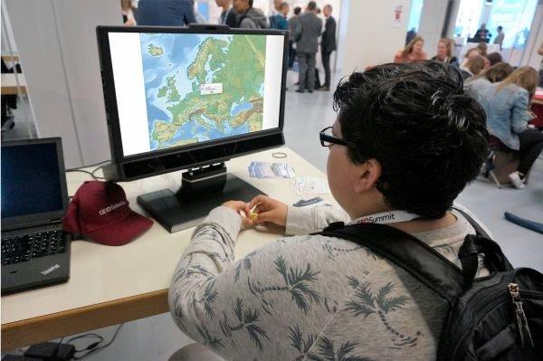
June 2016
This year at external pageGeoSummit, our group displayed a gaze-based Geo-Game. During the external pageGEOSchool Day, pupils and adults could expieriece how it feels to control geoinformation systems just by using their gaze. (articles in German only)
It was great fun changing the world in the blink of an eye.
Article about GoEco! in the ETH Energy Science Center News
April 2016
The ETH Energy Science Center (ESC) reports some intermediate results of the GoEco! project, in which currently 450 participants contribute to the development of a software that makes individual mobility more sustainable. Follow other news about GoEco! on our media webpage.
Article in VISIONEN
March 2016
VISIONEN is a quarterly issued journal edited by VIS (Verein der Informatikstudierenden - Association of Informatics Students at ETH Zurich) and features in its issue 4/2015 the new possibility for informatics students to attend our GIS courses. Link to Article and entire journal (in German only).
New SNSF Project: IGAMaps
25.09.2015
Our project proposal on „Intention-Aware Gaze-Based Assistance on Maps“ (IGAMaps) has been approved by the Swiss National Science Foundation. For a duration of three years we will investigate approaches for gaze-based intention recognition and assistance for the interaction with maps. external pageGeoGazeLab
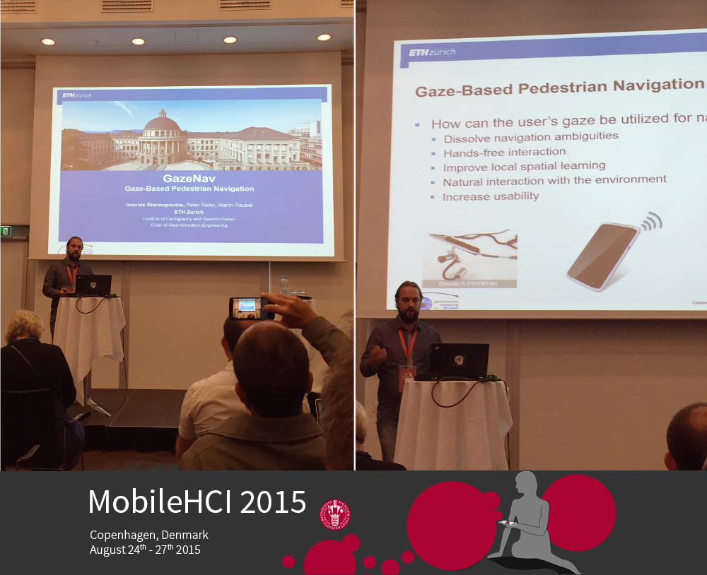
MobileHCI 2015
24.08.2015
Leading Mobile HCI researchers from all over the world meet in Copenhagen to present innovative research and gadgets. Our research group is present with 4 contributions.
Touchless devices, smart watches, bendable tablets and interconnected smart phones are just some of the gadgets presented at this year's Mobile HCI conference in Copenhagen. external pageRead more
OMLETH Best Paper
11.08.2015
The paper external pageAn evaluation method for location-based mobile learning based on spatio-temporal analysis of learner trajectories by Christian Sailer, Peter Kiefer, Joram Schito and Martin Raubal has been selected as the best paper at the external pageMobiscool-Workshop at the external pageMobileHCI 2015 Conference in Copenhagen. Based on this success we may now submit a full pager for a special issue of the external pageInternational Journal of Mobile HCI.
Best Paper Nomination and Gamification Newsletter Coverage
10.07.2015
Our paper A Taxonomy of Motivational Affordances for Meaningful Gamified and Persuasive Technologies authored by Paul Weiser, Dominik Bucher, Francesca Cellina and Vanessa De Luca was nominated for the Best Paper Award at the 3rd conference external pageICT for Sustainability in Copenhagen. In addition, the paper received coverage in the newsletter external pageGamification weekly issued by the Gamification Research Network.
ETH Winter School
11.06.2015
We are organizing a Winter School on Eye Tracking – Experimental Design, Implementation, and Analysis. The Winter School is going to take place 17-22 January 2016 in the conference center in external pageMonte Verità.
Workshop at the UbiComp Conference
21.04.2015
Our external pageGeoGazeLab is co-organizing a workshop at the external pageUbiComp conference: the workshop on “Pervasive Eye Tracking and Mobile Eye-Based Interaction“ (external pagePETMEI 2015). The workshop is concerned with eye tracking and gaze-based interaction in mobile and everyday (“ubiquitous”) situations, such as in pedestrian navigation.
Project with SWISS
15.01.2015
The external pageFederal Office of Civil Aviation is funding our project titled “Enhanced flight training programs for monitoring aircraft automation”. Goal of the project is the improvement of pilot training by using eye tracking. The project is a cooperation with external pageSWISS. As further project partners, the external pageNASA Ames Research Center and external pageProf. Dr. Robert Mauro (University of Oregon, USA) are involved.
Special Issue in "Spatial Cognition and Computation" planned
13.01.2015
We are soliciting contributions for a planned Special Issue on "Eye Tracking for Spatial Research" in the Journal „Spatial Cognition and Computation“. Submission deadline is 27 May 2015.Wir bitten um Beiträge zu einer geplanten Sonderausgabe zum Thema "Eye Tracking for Spatial Research" im Journal Spatial Cognition and Computation. Frist für die Einreichung ist der 27. Mai 2015.
LAMETTA - Location-Aware Mobile Eye Tracking for Tourist Assistance
10.12.2014
ETH Zurich is funding our project LAMETTA with an ETH Zurich Research Grant for three years, starting in 2015. Goal of the project is the investigation of gaze-based interaction methods for digital travel guides in urban environments.
Das App-Projekt «GoEco!» gewinnt den von EnergieSchweiz ausgeschriebenen Wettbewerb AppWelt 2014
10.12.2014
Das App-Projekt «GoEco!» der Institute ISAAC (SUPSI) und ETH Zürich - IKG denkt mit und berät den Anwender zu seinen Mobilitäts-Optionen. GoEco! überzeugte die Jury mit einer wertvollen Idee, einem stimmigen Antrag und einem schönen Design. Die tolle Arbeit wird mit dem ersten Platz und 5000 Franken belohnt. Die Sicht von Stefano Vannotti: «GoEco! ist eine smarte Idee, um uns das Mobilitätsverhalten bewusster zu machen».
LAMETTA - Location-Aware Mobile Eye Tracking for Tourist Assistance
ETH Zurich is funding our project LAMETTA with an ETH Zurich Research Grant for three years, starting in 2015. Goal of the project is the investigation of gaze-based interaction methods for digital travel guides in urban environments.
EDC Entwicklerforum
Die Professur Geoinformations-Engineering organisiert am 13. - 14. November 2014 das Esri Development Center (EDC) Entwicklerforum zum dem Thema „GIS-Technologien im Energiebereich”.
Die Integration erneuerbarer Energien zur Deckung des zukünftigen Energiebedarfs ist eine grosse Herausforderung. Planungsaufgaben im Bereich Energie sind eng verbunden mit räumlichen und zeitlichen Fragestellungen.
Als Esri Development Center (EDC) verfügt das Institut für Kartografie und Geoinformation an der ETH Zürich über herausragende Kompetenz bezüglich des Einsatzes von GIS-Technologien im Energiebereich.
DownloadInformation (PDF, 67 KB)
DownloadProgramm (PDF, 314 KB)