Finished Projects

Empirical use and Impact Analysis of MaaS
Project start: 01.09.2019
Project lead: Prof. Dr. Martin Raubal
Internal researcher: Henry Martin, Jannik Hamper
Funding: ETH Zurich Foundation
Individual private car use is inherently unsustainable when compared to shared modes. Yet, it is one of the main travel modes around the world, often due to a lack of alternatives. The introduction of novel shared travel modes and their integration with public transport (Mobility as a Service, MaaS), promises to enable seamless intermodal travel, thus facilitating a behavioral change from private car use to more sustainable, shared modes.
Core of the EIM project is external pageYUMUV, a real world MaaS case-study conducted by the Swiss Federal Railways (external pageSBB) and the public transport providers in the cities of external pageBasel, external pageBern and external pageZurich. The Mobility Information Engineering Lab (MIE) at the Chair of Geoinformation Engineering and the Institute for Transport Planning and Systems (IVT) provide academic support for the design and the analysis of this study.
We use the data generated in this study to advance our so-far limited scientific understanding of how MaaS changes travel behavior (e.g., mode choice, car ownership) or how more sustainable travel behavior can be encouraged (e.g., through optimized service bundling or real-time mobility prediction).
We plan to develop an integrated representation of relevant mobility and context data based on person-specific graphs. This allows the application of both state-of-the-art research methods in transport behavior (hybrid choice and multivariate probit models) and geographic information science (spectral clustering, graph neural networks) on such heterogenous data.
The EIM project is funded by the external pageETH Mobility Initiative
Context-Aware Mobility Mining Tools - COMMIT
Project start: 01.10.2018
Project lead: Prof. Dr. Martin Raubal
Internal researchers: Dr. Pengxiang Zhao, Dominik Bucher, Henry Martin
Funding: SDSC (Swiss Data Science Center)
Location-acquisition technologies provide ample opportunities regarding the monitoring, management, and regulation of human mobility behavior, thereby avoiding some potential negative effects (e.g. traffic jams, fuel consumption). COMMITcall_made project aims to develop serials of context-aware computational methods for evaluating, predicting and analyzing human mobility behavior based on massive trajectory data and related contextual data. It can be expected to have high societal significance and relevance for a broad range of scientific disciplines and related industrial sectors.
Pilot Eye Gaze and Gesture tracking for Avionics Systems using Unobtrusive Solutions (PEGGASUS)
Project start: 01.01.2019
ETHZ Team: Prof. Dr. Martin Raubal (project lead) Luis Lutnyk, Dr. David Rudi, Dr. Peter Kiefer
Funding: This project has received funding from the Clean Sky 2 Joint Undertaking under the European Union’s Horizon 2020 research and innovation program under grant agreement No. 821461
PEGGASUS will create the first cockpit based crew monitoring system for enhanced flight safety, improved workload management and better crew awareness. To realize this goal we have brought together leading innovation technology companies, world class research institutes and key avionics experts.
The project will go beyond state-of-the-art artificial intelligence algorithms, that will be tailored with data collected from a dedicated vision system. Initial focus will be on flight safety and pilot comfort through eye-gaze analysis and hand gestures.
PEGGASUS, creating the first step forward to seamless cockpit interactions.
Our collaborators are: SERMA Ingenierie, csem, Swiss International Airlines, Thales
Optimizing the potential impact of personal and autonomous electric mobility on grid stability
Project Start: 01.05.2019
Internal Researchers: Prof. Dr. Martin Raubal, Dr. Pengxiang Zhao, Henry Martin
Funding: Innosuisse – Swiss Innovation Agency
The high power demand of electric vehicles (EVs) during charging forces us to study Swiss mobility and energy systems as a whole and makes the consideration of the grid impact a requirement. Vehicle-to-grid (V2G) opens an avenue for the successful integration of EVs in the energy system. This project will offer support for the fulfillment of the Swiss Energy Strategy 2050 from the perspective of energy infrastructure and smart charging. The outcome of this project will provide optimal charging schedules for electric vehicles by investigating the interaction between the grid and electric vehicles.

Decision Support System for Personalized Ride-Sharing Services
Project Start: 01.05.2019
Internal Researchers: Prof. Dr. Martin Raubal, Dominik Bucher, Dr. Pengxiang Zhao
Funding: Innosuisse – Swiss Innovation Agency
Various studies have demonstrated that ridesharing and carpooling are beneficial to alleviate traffic congestions and to reduce CO2 emissions, fuel/energy consumption as well as travel costs. This project aims to offer personalized, short-term and automated rideshare planning based on passively tracked movement data, considering travel time uncertainty and users’ travel preferences and schedules. This project will provide tangible support for the fulfillment of the “Energy Strategy 2050” objectives via an information service for sustainable mobility choices from the perspective of sharing mobility.

MobileHCI4GIS: Competence development mobile user interfaces in GIS
MobileHCI4GIS: Competence development mobile user interfaces in GIS
Project start: 01.09.2018
Project leader: Dr. Peter Kiefer
Internal Researchers: Fabian Göbel, Tiffany Kwok
Funding: Innovedum – Advancing education at ETH
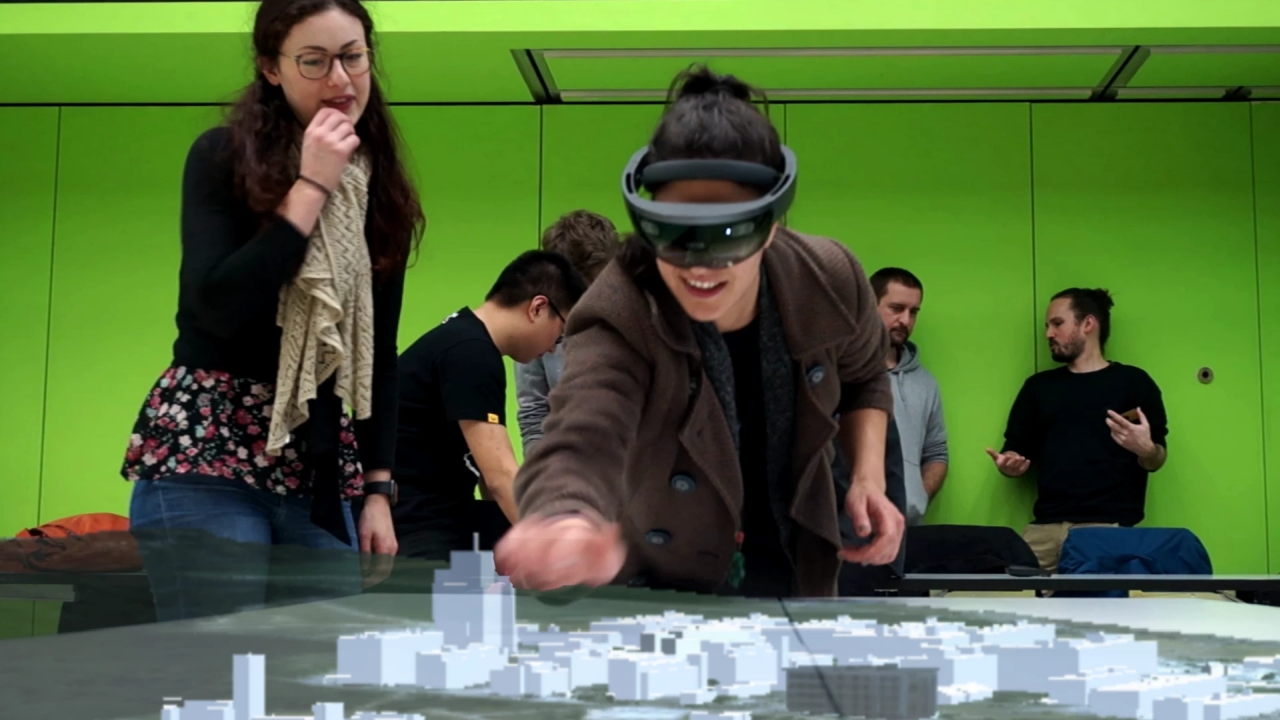
The project MobileHCI4GIS extends the existing Master course "Mobile GIS and Location-Based Services" with a part in which students acquire competences for the design and development of geodata-based applications for holographic glasses (e.g. Microsoft HoloLens system). Holographic user interfaces are particularly relevant for the field of geographic information systems because spatial information (e.g., maps or 3D city models) can be visualized and interacted with spatially on such user interfaces. In the scope of the MobileHCI4GIS project, a didactic concept will be developed which will be particularly tailored to the pre-knowledge, the interests, and the requirements of the Geomatics job market.
Link to Learning and Teaching Fair at ETH 2020.
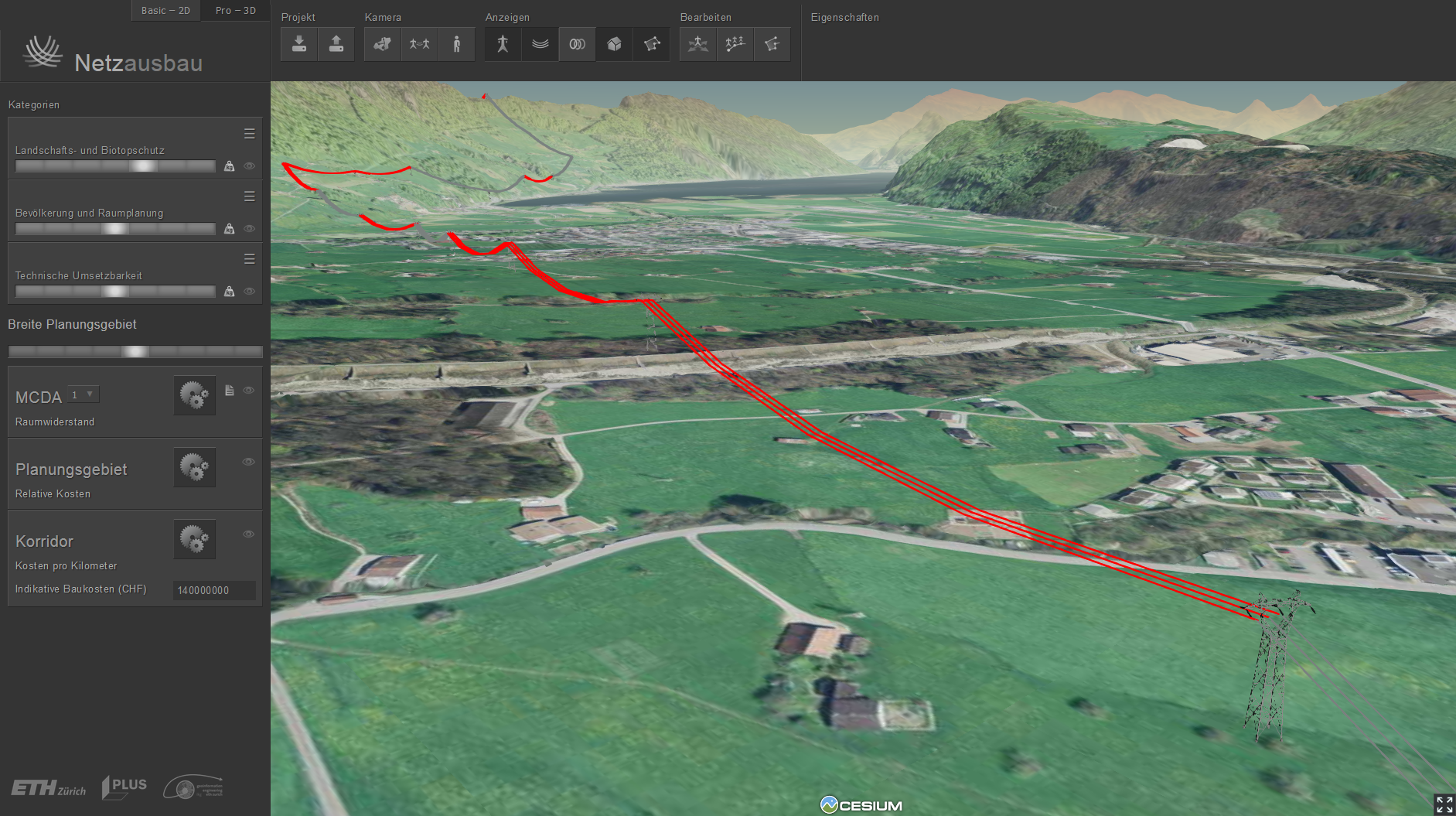
Enhancing the 3D DSS for supporting the planning of electric power systems: Integration of underground cables
Project Start: 01.06.2018
Project Leader: Prof. Dr. Martin Raubal
Internal Researcher: Joram Schito
Funding: Bundesamt für Energie BFE
Project Partners: Swissgrid, ewz, elia, Gilytics GmbH
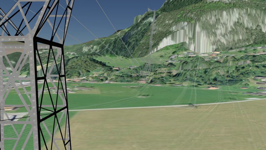
Geographic Information Systems (GIS) allow calculating and visualizing power line corridors in 3D. However, existing approaches are limited to overhead lines. The goal of this project is therefore to develop an inte-grative approach that models overhead lines and underground cables taking into account geological, infrastructural, ecological, as well as socio-economic aspects and to integrate the algorithm into an existing 3D web-GIS-platform – the 3D Decision Support System (3D DSS) of ETH Zurich.
More information
Future Swiss Electrical Infrastructure – Swiss Competence Center for Energy Research
Project Start: 01.08.2014
Project Leader: Prof. Dr. M. Raubal
Internal Researchers: Prof. Dr. M. Raubal, René Buffat
Funding: CTI (Commission for Technology and Innovation)
The SCCER Future Swiss Electrical Infrastructure (FURIES) join the competences of the top Swiss academic and industrial actors in the area of power/energy systems. FURIES is expected to shape the next generation of the electrical Swiss infrastructure in all its layers, from transmission to distribution, enabling a vast penetration of renewable energy resources in order to facilitate the Swiss nuclear-power phase-out.
IKG is part of Work Package 2, Bulk Multi-Energy Grids. Here we created a detailed database of potential new sites for additional pumped hydro storage in the Swiss Alps. Moreover, we are working on the topic of transmission line siting, to make sure that new smart grids will be built in a sustainable way, reducing both their environmental and social impacts.
Enhanced flight training programs for monitoring aircraft automation
Project Start: 01.07.2015
Project Leader: SWISS International Airlines
Co-Leader: Prof. Dr. Martin Raubal
Internal Researcher: David Rudi
Funding: Swiss Federal Office of Civil Aviation (BAZL)
The Federal Office of Civil Aviation will fund the project on “Enhanced flight training programs for monitoring aircraft automation” (January 2015 – June 2017).
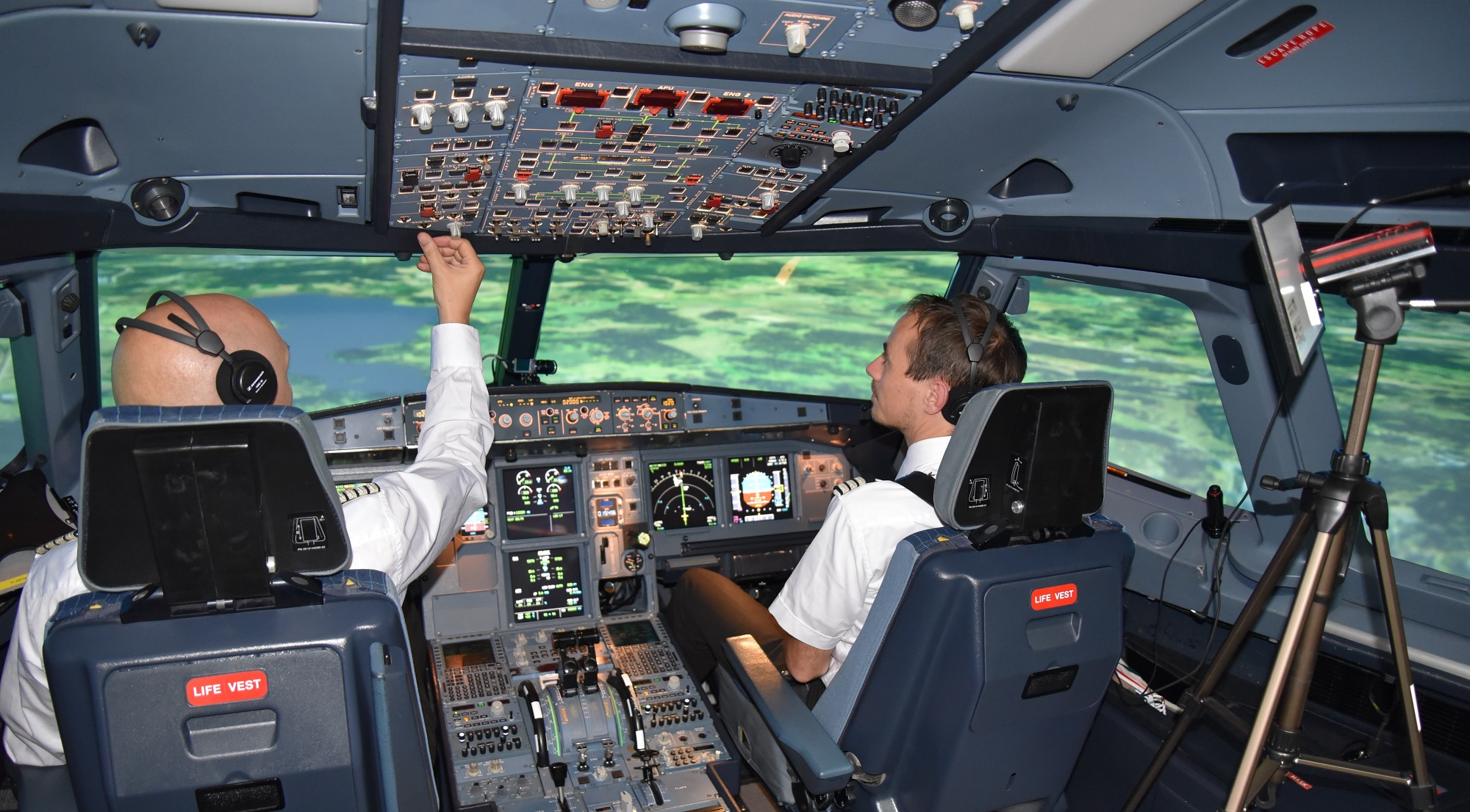
We will conduct eye tracking studies with professional pilots in flight simulators to analyze the effectiveness of visual scan strategies during aircraft operation. The ultimate goal is to include the obtained insights into pilot training programs. Read more about our research on external pageaviation.
The project is a cooperation with an internationally operating airline (external pageSWISS International Airlines). Further collaborators are the external pageNASA Ames Research Center and external pageProf. Dr. Robert Mauro (University of Oregon, USA).
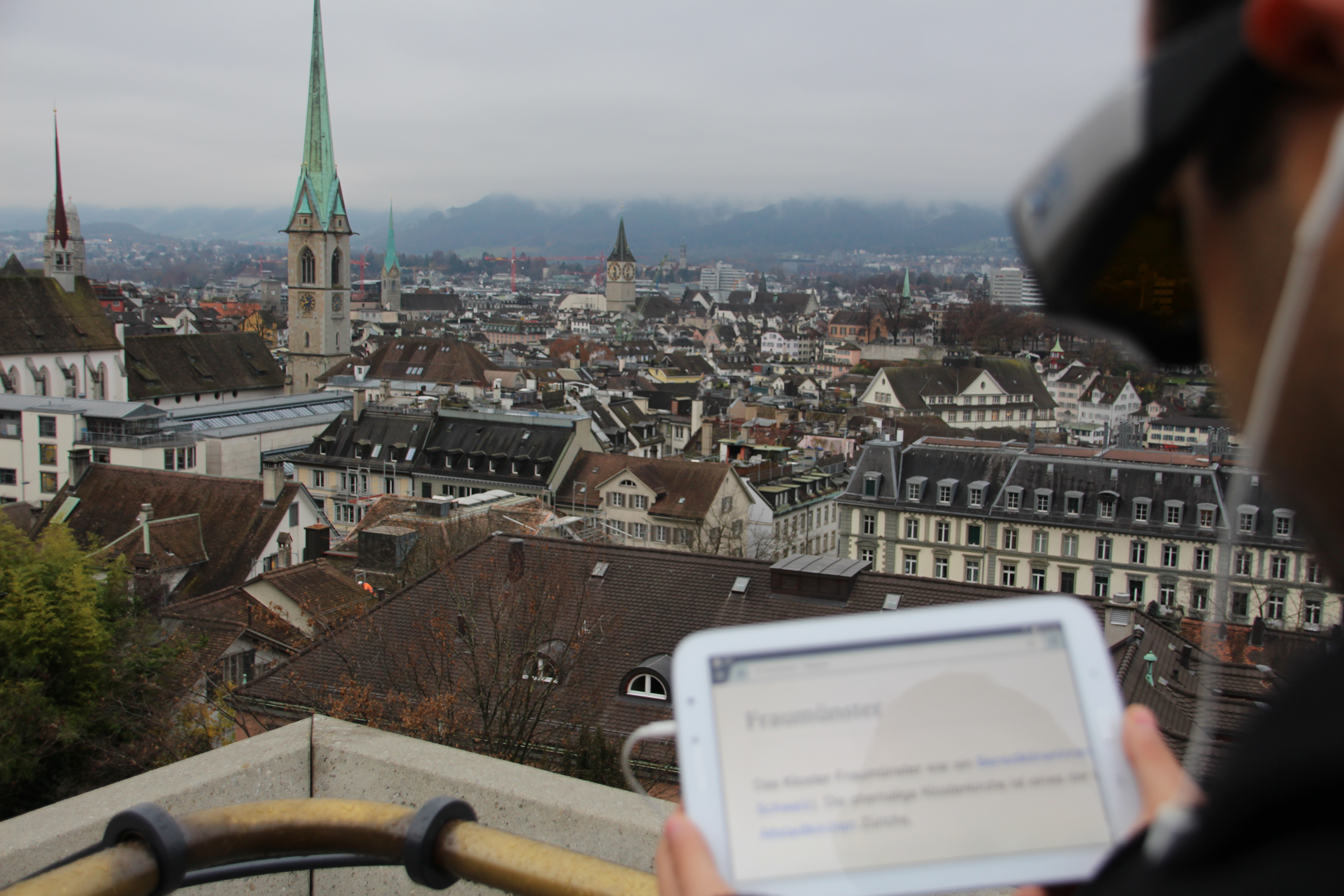
Location-Aware Mobile Eye Tracking for Tourist Assistance (LAMETTA)
Project Start: 01.09.2015
Project Leader: Dr. Peter Kiefer
Internal Researcher: Tiffany CK Kwok
Funding: ETH Zurich Research Grant
external pageMore Information
LAMETTA is a research project on gaze-based interaction techniques in outdoor environments. The goals of this project are to design and develop an outdoor gaze-based interaction platform and to investigate explicit and implicit gaze-based interaction methods for tourists visually exploring a city panorama. The project envisions a mobile assistance system that triggers information services based on the user's gaze in an intuitive, efficient, and privacy-preserving way for touristic areas. The insights from this project will also be helpful for other outdoor gaze-based interactions scenarios.
Mobility Profiles and Logistics Concept for Small-scale Food Producers
Project Start: 01.02.2018
Project Leader: Prof. Dr. Martin Raubal
Internal Researcher: Dr. David Jonietz, Dominik Bucher
Funding: Alpinavera
Especially in rural areas of Switzerland, transport costs are a critical factor for small-scale food producers, who frequently transport relatively small amounts of goods over large distances. In collaboration with external pagealpinavera, we will conduct a GNSS-assisted travel survey to assess the current stage of transport behaviour and needs, and build on the resulting insights to develop and test a range of alternative scenarios for their potential economic and ecological benefits.

SBB Green Class
Projectstart: 27.10.2016
Project Lead: Schweizerische Bundesbahnen (SBB)
Scientific Lead: Prof. Dr. Martin Raubal
Internal Researchers: Dr. David Jonietz, Dominik Bucher
Commissioner: Schweizerische Bundesbahnen (SBB)
external pageSBB Green Class (in German only)
In the context of integrated mobility offers currently gaining in importance, SBB will collaborate with BMW Switzerland to develop a combined mobility solution by Fall 2016, and test it with 100 test customers in a one-year pilot project.
In the course of a parallel scientific study, the effects of such cooperative, multi-modal mobility offers on the customers' mobility behavior will be evaluated by means of GPS-based movement tracking as well as qualitative and quantitative surveys.

Intention-Aware Gaze-Based Assistance on Maps (IGAMaps)
Project Start: 01.02.2016
Project Leader: Dr. Peter Kiefer / Prof. Dr. Martin Raubal
Internal Researcher: Fabian Göbel
Funding: Swiss National Science Foundation
external pageMore Information
Adaptive human computer interfaces can significantly facilitate the interaction with digital maps. In this project we investigate on how to provide meaningful map adaptation based on the user's visual attention. We build on the assumption that, since maps are primarily perceived with the visual sense, the user's gaze on a map can be used to recognize her cognitive states, which allows for personalized map adaptations. Questions addressed include:
- Can we infer intentions from the visual attention on a map?
- How should a map adaptation be designed to be helpful?
- What is the general user acceptance of gaze-based map adaptions?
GoEco! A community based eco-feedback approach to promote sustainable personal mobility styles
Project Start: 01.01.2015
Project End: 31.03.2018
Project Leader: Dr. R. Rudel
Co-Leader: Prof. Dr. M. Raubal
Internal Researcher: Dominik Bucher
Funding: SNF - Abteilung Nationale Forschungsprogramme
The external pageresults of the study can be accessed via the research database P3 of the Swiss National Science Foundation.
Current mobility patterns are still dominated by car use, which accounts for high energy consumption, adverse effects on health, and also contributes significantly to global climate change. In the last years a number of alternative and energy-efficient mobility options have emerged; yet, these still tend to be neglected due to a deep-rooted car dependency.
How can we encourage people to go by bike or walk, use the public transportation system, rely on emerging alternatives such as car-sharing and car-pooling systems or even organize virtual meetings to avoid traveling alltogether? GoEco! seeks to overcome traditional awareness-raising approaches and, by taking advantage of the wide acceptance of smartphones and tablets, proposes an innovative, community-based approach, directly addressing citizens and their everyday mobility choices. The project is a cooperation with external pageSUPSI, originated from external pageSCCER Mobility, and is funded via the external pageNRP 71.
Application of 3D Geographic Information Systems for transparent and sustainable planning of electric power systems
Project Start: 01.10.2014
Project Leader: Prof. Dr. M. Raubal
Internal Researcher: Joram Schito
Funding: Swiss Federal Office of Energy (SFOE), Swissgrid, BKW Energie AG, Verbund AG
Defining the optimal path of transmission lines is a time consuming planning task that is often impacted by strong social opposition. The scope of this project is the development of an integrated 3D GIS web-platform to define the optimal path of a new transmission line, to enhance the communication among all stakeholders involved in a project and to reduce the social opposition. An improved 3D visualization to be utilized for community-based decision-making will demonstrate to the stakeholders the impact of the new project on the surroundings.
OMLETH II: Development of the platform for location-based mobile learning at ETH and multidisciplinary evaluation
Project Start: 01.01.2016
Project Leader: Prof. Dr. M. Raubal / Dr. P. Kiefer
Internal Researcher: Christian Sailer
Funding: Innovedum ETH Zürich Innovedum
OMLETH II in the Innovedum project database
Based on the findings of OMLETH I (Link) the platform will technically be improved and their use again evaluated in cooperation with the Chair of the History of Urban Design with larger numbers of students in the follow-up project. The results and findings will be incorporated into a knowledge platform for location-based mobile learning. The experience gained will also be implemented as an interactive assistance function in OMLETH editor for lecturers. These experiences are complemented by new collaborations with courses from the D-USYS and the Material Archive of Baubibliothek. Prospects of further areas (within the ETH) are kindly invited to sign up.

Infrastructure for Future Elecricity Markets (AFEM-INFRA)
Project Start: 01.10.2014
Project Leader: Dr. T. Demiray
Co-Leader: Prof. Dr. M. Raubal
Internal Researcher: Stefano Grassi
Funding: SNF - Abteilung Nationale Forschungsprogramme
external pageMore information at NRP Database
The key issues addressed in the umbrella project "Assessing Future Electricity Markets" (AFEM) require a preliminary quantification of the exploitable potential of stochastic renewable energy (RE) sources and a feasibility analysis of their grid integration. Within the AFEM project, IKG’s task in the frame of the AFEM-INFRA work package is the identification of the spatial distribution of the wind and solar photovoltaic resource and its corresponding electricity generation. The long-term and 10minutes resolution energy production will be quantified and fed into the nodes of the high-voltage power grid in order to assess the response and thus to estimate the necessary reserves as a function of the economic scenarios.
OMLETH: A platform for location-based mobile learning at ETH Zurich
Project Duration: 01.08.2014–31.12.2015
Project Leader: Prof. Dr. M. Raubal / Dr. P. Kiefer
Internal Researcher: Christian Sailer
Funding: Innovedum ETH Zürich
OMLETH I in the Innovedum project database
Our project OMLETH is funded by the Innovedum fund of ETH Zurich. OMLETH is a joint research project between the Chair for the History of Urban Design and the Chair of Geoinformation Engineering.
Design, operating strategies and potential of a biogenic CHP swarm
Project Duration: 01.11.2012–31.12.2015
Project Leader: Prof. Dr. K. Boulouchos
Internal Researchers: Fabrizio Noembrini, Martin Raubal, René Buffat, Stefano Grassi, Turhan Demiray
External Researchers: Hal Turton, Kannan Ramachandran
Funding: Swiss public institutions
An increasing share of fluctuating renewable electricity production requires more flexibility in stabilising the electricity grid. Decentralised biogenic combined heat and power plants could play a significant role. The potential of this approach is analysed by spatial-temporal based modelling.
Characterizing human mobility from mobile phone usage
Project Duration: 01.09.2012–31.12.2013
Project Leader: Prof. Dr. M. Raubal
PhD Candidate: Yihong Yuan
Funding: Schweizerischer Nationalfond (SNF)
Our mobile information society depends increasingly on the use of Information and Communication Technologies (ICTs) such as mobile phones. People’s usage of these technologies impacts many aspects of their lives but the relationship between ICT and human activities is not fully known. An understanding of this relationship will help in predicting people’s mobility patterns and provide important guidelines for maintaining sustainable transportation, updating environmental policies, and designing early warning and emergency response systems.
The goal of this project is to develop a framework for extracting and characterizing human mobility patterns from georeferenced mobile phone datasets. We analyze the different types of information that can be stored in mobile phone datasets, and develop human mobility models and data mining methodologies for spatio-temporal knowledge discovery. These models provide the basis for investigating and quantifying the relationship between human physical travel, communication travel, and environmental structure. Our research also addresses issues of uncertainty, which arise from the natural variability of human mobility, the inaccuracy and imprecision of recorded trajectories, and the imperfection of the underlying models. In order to evaluate the developed models and the relationship between human mobility patterns, spatial structure, and mobile phone usage, we will utilize a large dataset of northeast China.
This research will enhance our understanding of the relationship between human mobility and ICT in general, and between human mobility patterns and mobile phone usage in particular. We will advance conventional geographic knowledge discovery by focusing on knowledge extraction from sparse datasets with low resolution and individual attributes. The case study from northeast China allows us to examine the influence of mobile phone usage in a highly populated and rapidly developing country.
The project contributes to both scientific advances and professional development. The application of advanced geographic knowledge discovery methods to mobile data is highly important in the age of instant access and extremely relevant in diverse fields, ranging from geography to transportation, planning, and economics. The results of our project can be directly utilized by makers of environmental and transportation policies in order to direct people to more sustainable behaviors, as well as private business people in the Location-Based Services market. Our dataset from China covers over 5 million people and is therefore an excellent case study for the examination of public policies by a strong central government.