Abgeschlossene Projekte

Empirical use and Impact Analysis of MaaS
Projekt Start: 01.09.2019
Projektleitung: Prof. Dr. Martin Raubal
Wissenschaftliche Mitarbeiter: Henry Martin, Jannik Hamper
Förderung: ETH Zurich Foundation
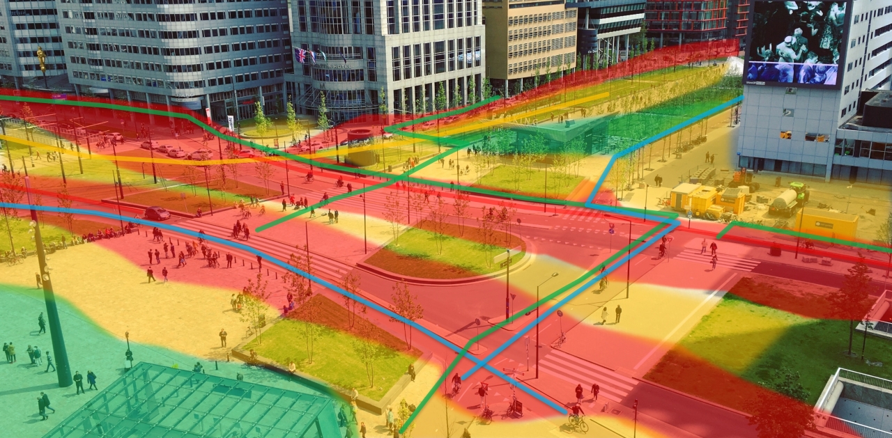
Der motorisierte Individualverkehr ist im Vergleich zu vielen anderen Verkehrsmitteln (Öffentlicher Verkehr, Car-Sharing, Velo, …) wenig nachhaltig. In den meisten Städten der Welt ist er allerdings das wichtigste Verkehrsmittel, das liegt oft an einem Mangel an flexiblen und leicht benutzbaren Alternativen. Eine Mögliche Lösung dieses Problems liegt in der Einführung gemeinsam genutzter Verkehrsmittel und ihrer Integration in den öffentlichen Verkehr (Mobility as a Service, MaaS). MaaS hat das Potential, nahtloses intermodales Reisen zu ermöglichen und damit eine Veränderung des Mobilitätsverhaltens, von der privaten Autonutzung hin zu nachhaltigeren, gemeinsam genutzten Verkehrsmitteln zu erleichtern.
Kernstück des EIM-Projekts ist externe SeiteYUMUV, eine MaaS-Pilotstudie, die von den Schweizerischen Bundesbahnen (externe SeiteSBB) und den öffentlichen Verkehrsbetrieben in den Städten externe SeiteBasel, externe SeiteBern und externe SeiteZürich durchgeführt wird. Das Mobility Information Engineering Lab (MIE) am Lehrstuhl für Geoinformation-Engineering und das Institut für Verkehrsplanung und Transportsysteme (IVT) begleiten die Konzeption, Durchführung und die Auswertung der Studie wissenschaftlich.
Die Ergebnisse der Studie können verwendet werden, um unser Verständnis darüber, wie MaaS das Reiseverhalten verändert (z.B. Verkehrsmittelwahl, Autobesitz) oder wie ein nachhaltigeres Reiseverhalten gefördert werden kann (z.B. durch optimiertes Bundling oder individuelle Mobilitätsprognosen) zu vertiefen.
Wir planen die Entwicklung einer integrierten Darstellung relevanter Mobilitäts- und Kontextdaten auf der Basis von personenspezifischen Graphen. Dies ermöglicht sowohl die Anwendung von Methoden aus der Verkehrsforschung (z.B. hybrid choice und multivariate probit Modelle) als auch aus der Geoinformationswissenschaft (z.B. Spectral Clustering oder graph neural networks) auf sehr heterogenen Daten.
Das EIM Projekt ist Teil der externe SeiteETH Mobilitäts-Initiative
Context-Aware Mobility Mining Tools - COMMIT
Project start: 01.10.2018
Project Lead: Prof. Dr. Martin Raubal
Internal Researchers: Dr. Pengxiang Zhao, Dominik Bucher, Henry Martin
Funding: SDSC (Swiss Data Science Center)
Location-acquisition technologies provide ample opportunities regarding the monitoring, management, and regulation of human mobility behavior, thereby avoiding some potential negative effects (e.g. traffic jams, fuel consumption). externe SeiteCOMMIT project aims to develop serials of context-aware computational methods for evaluating, predicting and analyzing human mobility behavior based on massive trajectory data and related contextual data. It can be expected to have high societal significance and relevance for a broad range of scientific disciplines and related industrial sectors.
Pilot Eye Gaze and Gesture tracking for Avionics Systems using Unobtrusive Solutions (PEGGASUS)
Project start: 01.01.2019
ETHZ Team: Prof. Dr. Martin Raubal (project lead) Luis Lutnyk, David Rudi, Dr. Peter Kiefer
Funding: This project has received funding from the Clean Sky 2 Joint Undertaking under the European Union’s Horizon 2020 research and innovation program under grant agreement No. 821461
PEGGASUS will create the first cockpit based crew monitoring system for enhanced flight safety, improved workload management and better crew awareness. To realize this goal we have brought together leading innovation technology companies, world class research institutes and key avionics experts.
The project will go beyond state-of-the-art artificial intelligence algorithms, that will be tailored with data collected from a dedicated vision system. Initial focus will be on flight safety and pilot comfort through eye-gaze analysis and hand gestures.
PEGGASUS, creating the first step forward to seamless cockpit interactions.
Our collaborators are: SERMA Ingenierie, csem, Swiss International Airlines, Thales
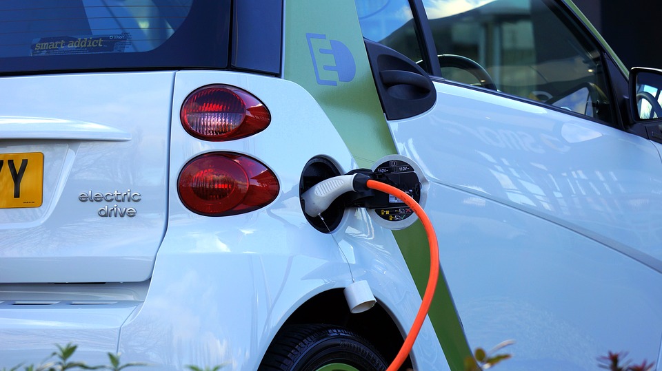
Optimizing the potential impact of personal and autonomous electric mobility on grid stability
Project Start: 01.05.2019
Internal Researchers: Prof. Dr. Martin Raubal, Dr. Pengxiang Zhao, Henry Martin
Funding: Innosuisse – SCCER Mobility - Digitalization
The high power demand of electric vehicles (EVs) during charging forces us to study Swiss mobility and energy systems as a whole and makes the consideration of the grid impact a requirement. Vehicle-to-grid (V2G) opens an avenue for the successful integration of EVs in the energy system. This project will offer support for the fulfillment of the Swiss Energy Strategy 2050 from the perspective of energy infrastructure and smart charging. The outcome of this project will provide optimal charging schedules for electric vehicles by investigating the interaction between the grid and electric vehicles.
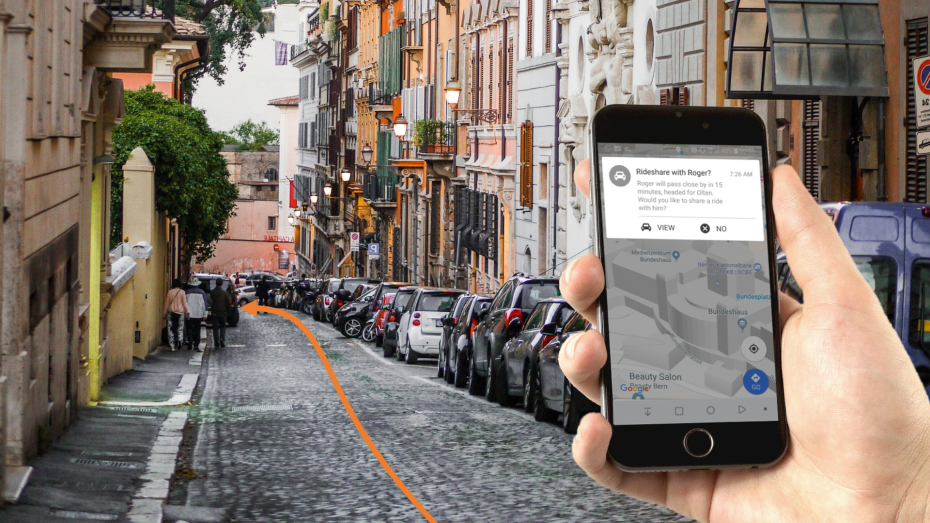
Decision Support System for Personalized Ride-Sharing Services
Project Start: 01.05.2019
Internal Researchers: Prof. Dr. Martin Raubal, Dominik Bucher, Dr. Pengxiang Zhao
Funding: Innosuisse – SCCER Mobility - Digitalization
Various studies have demonstrated that ridesharing and carpooling are beneficial to alleviate traffic congestions and to reduce CO2 emissions, fuel/energy consumption as well as travel costs. This project aims to offer personalized, short-term and automated rideshare planning based on passively tracked movement data, considering travel time uncertainty and users’ travel preferences and schedules. This project will provide tangible support for the fulfillment of the “Energy Strategy 2050” objectives via an information service for sustainable mobility choices from the perspective of sharing mobility.
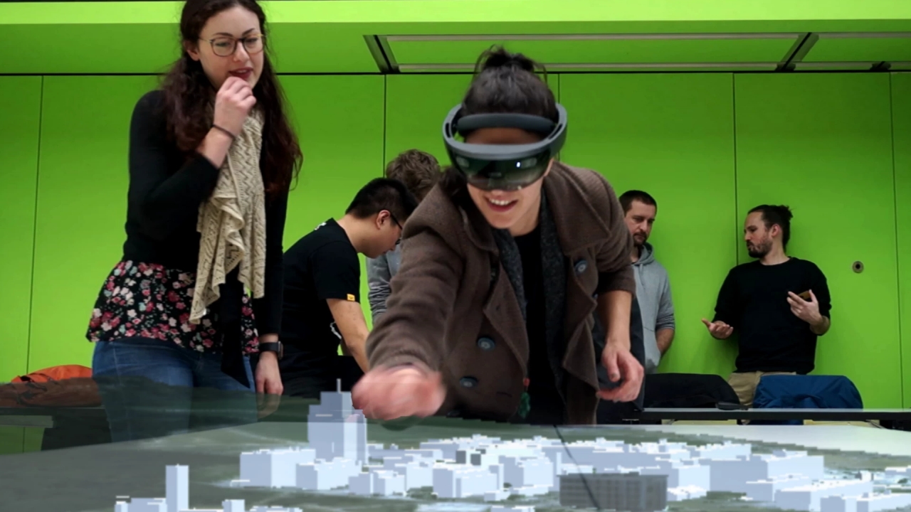
MobileHCI4GIS: Kompetenzaufbau mobile Nutzerschnittstellen im GIS-Bereich
Projektstart: 01.09.2018
Projektleiter: Dr. Peter Kiefer
Wissenschaftliche Mitarbeiter: Fabian Göbel, Tiffany Kwok
Förderung: Innovedum – Advancing education at ETH
Das Projekt MobileHCI4GIS erweitert die Master-Lehrveranstaltung "Mobile GIS and Location-Based Services" um einen Teil, in dem Studierende ihre Kompetenzen für das Design und die Entwicklung von auf Geodaten basierten Anwendungen für holographische Brillen erweitern (z.B. Microsoft HoloLens). Die besondere Relevanz der holographischen Nutzerschnittstellen für den Bereich Geoinformationssysteme besteht darin, dass räumliche Informationen (z.B. Karten oder 3D-Stadtmodelle) auf einer solchen Nutzerschnittstelle auch räumlich dargestellt und zur Interaktion zur Verfügung gestellt werden. Im Projekt MobileHCI4GIS wird ein didaktisches Konzept entwickelt, das besonders auf das Vorwissen, die Interessen sowie die Anforderungen des Arbeitsmarkts für Geomatiker und Geomatikerinnen zugeschnitten ist.
Link zur Präsentation an der "Learning and Teaching Fair" der ETH 2020.
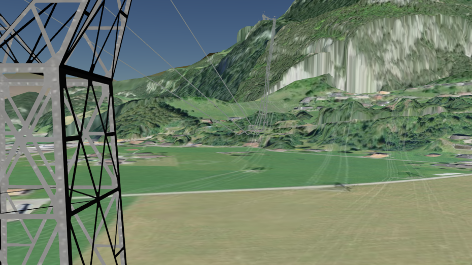
Erweiterung des 3D DSS zur Unterstützung der Planung von elektrischen Versorgungsleitungen: Integration von Erdkabeln
Projektstart: 01.06.2018
Projektleitung: Prof. Dr. Martin Raubal
Wissenschaftliche Mitarbeiter: Joram Schito
Förderung: Bundesamt für Energie BFE
Projektpartner: Swissgrid, ewz, elia, Gilytics GmbH
Geografische Informationssysteme (GIS) ermöglichen es, Korridore für Hochspannungsleitungen zu berechnen und in 3D darzustellen. Bestehende Ansätze beschränken sich jedoch auf Freileitungen. Ziel dieses Projektes ist die Entwicklung eines integrativen Ansatzes, der den optimalen Verlauf von Freileitungen und Erdkabeln unter Berücksichtigung geologischer, infrastruktureller, ökologischer und sozioökonomischer Aspekte berechnet und in eine bestehende 3D Web-GIS-Umgebung, das 3D Decision Support System (3D DSS), integriert.
Mehr Informationen
Future Swiss Electrical Infrastructure – Swiss Competence Center for Energy Research
Project start: 01.08.2014
Project leader: Prof. Dr. M. Raubal
Internal Researchers: Prof. Dr. Martin Raubal, Dr. René Buffat
Funding: CTI (Commission for Technology and Innovation)
The SCCER Future Swiss Electrical Infrastructure (FURIES) join the competences of the top Swiss academic and industrial actors in the area of power/energy systems. FURIES is expected to shape the next generation of the electrical Swiss infrastructure in all its layers, from transmission to distribution, enabling a vast penetration of renewable energy resources in order to facilitate the Swiss nuclear-power phase-out.
IKG is part of Work Package 2, Bulk Multi-Energy Grids. Here we created a detailed database of potential new sites for additional pumped hydro storage in the Swiss Alps. Moreover, we are working on the topic of transmission line siting, to make sure that new smart grids will be built in a sustainable way, reducing both their environmental and social impacts.
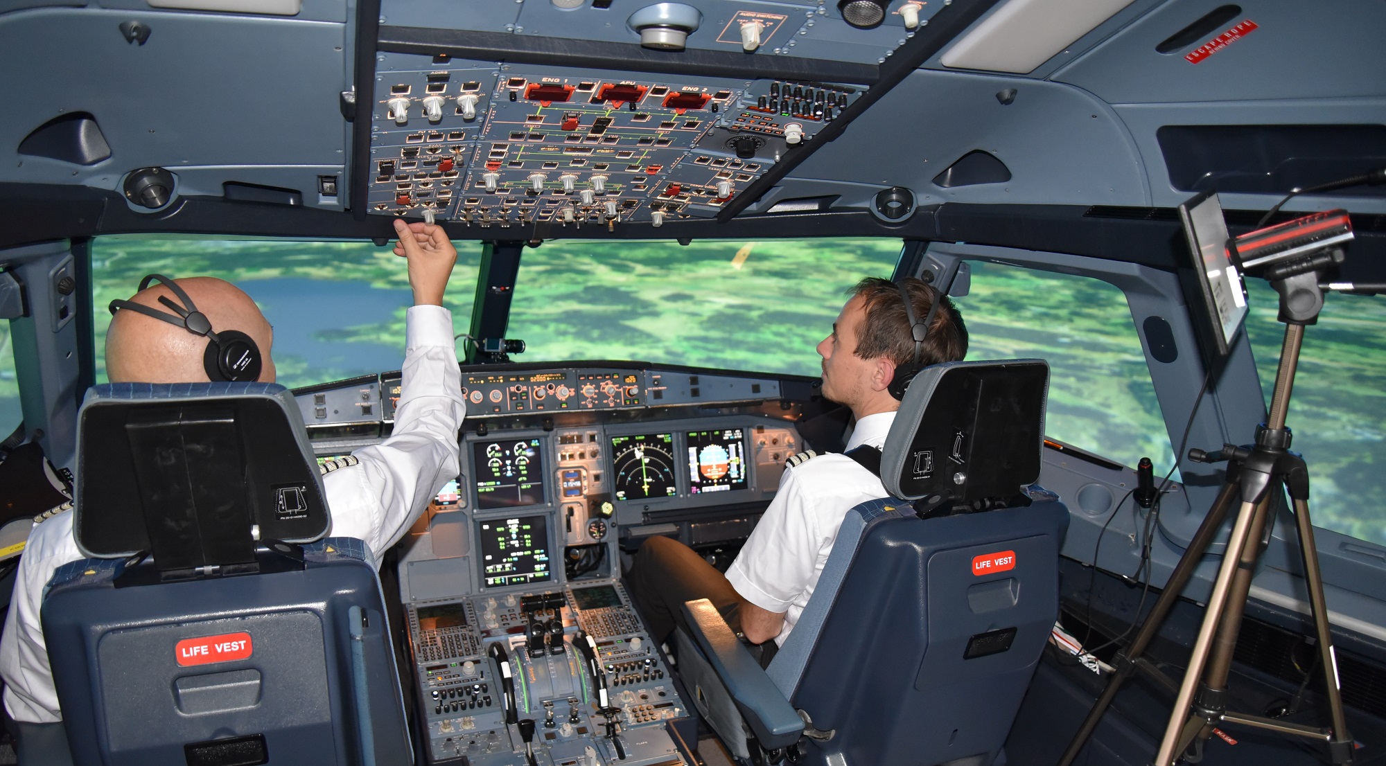
Enhanced flight training programs for monitoring aircraft automation
Projektstart: 01.07.2015
Projektleitung: SWISS International Airlines
Co-Projektleiter: Prof. Dr. Martin Raubal
Wissenschaftlicher Mitarbeiter: David Rudi
Förderung: Bundesamt für Zivilluftfahrt (BAZL)
The Federal Office of Civil Aviation will fund the project on “Enhanced flight training programs for monitoring aircraft automation” (January 2015 – June 2017).
We will conduct eye tracking studies with professional pilots in flight simulators to analyze the effectiveness of visual scan strategies during aircraft operation. The ultimate goal is to include the obtained insights into pilot training programs. Read more about our research on externe Seiteaviation.
The project is a cooperation with an internationally operating airline (externe SeiteSWISS Interntional Airlines). Further collaborators are the externe SeiteNASA Ames Research Center and externe SeiteProf. Dr. Robert Mauro (University of Oregon, USA).
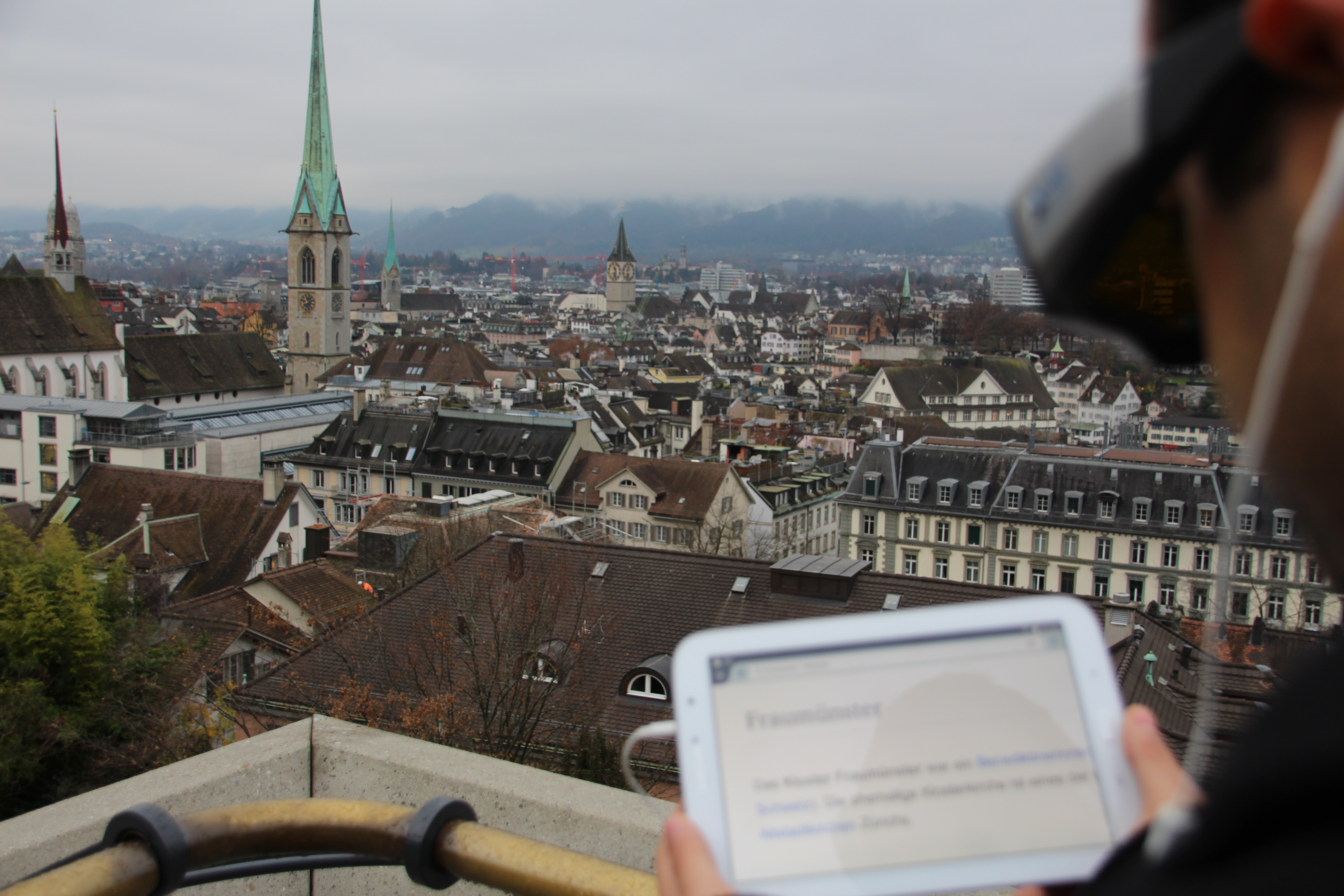
Location-Aware Mobile Eye Tracking for Tourist Assistance (LAMETTA)
Projektstart: 01.09.2015
Projektleiter: Dr. P. Kiefer
Wissenschaftlicher Mitarbeiter: Tiffany CK Kwok
Förderung: ETH Zurich Research Grant
externe SeiteMehr Informationen
LAMETTA is a research project on gaze-based interaction techniques in outdoor environments. The goals of this project are to design and develop an outdoor gaze-based interaction platform and to investigate explicit and implicit gaze-based interaction methods for tourists visually exploring a city panorama. The project envisions a mobile assistance system that triggers information services based on the user's gaze in an intuitive, efficient, and privacy-preserving way for touristic areas. The insights from this project will also be helpful for other outdoor gaze-based interactions scenarios.
Fahrprofile & Logistikkonzept für Kleinmengen – alpinavera
Projektstart: 01.02.2018
Projektleitung: Prof. Dr. Martin Raubal
Wissenschaftliche Mitarbeiter: Dr. David Jonietz, Dominik Bucher
Förderung: alpinavera
In den ländlichen Gebieten der Schweiz sind Transportkosten für die in kleinen Mengen lokal produzierenden Lebensmittel- und Spezialitätenhersteller ein grosser Kostenfaktor. Zusammen mit dem Verein externe Seitealpinavera entwickelt das Mobility Information Engineering Lab ein Kleinmengen-Logistikkonzept. Ziel der Arbeit ist es, basierend auf dem per GPS-Tracking erhobenen status quo des Transportverhaltens sämtlicher Beteiligter alternative Konzepte und ihre möglichen ökonomischen und ökologischen Nutzen aufzuzeigen.
Mehr Informationen (nur in Englisch)

SBB Green Class
Projektstart: 27.10.2016
Projektleitung: Schweizerische Bundesbahnen (SBB)
Wissenschaftliche Leitung: Prof. Dr. Martin Raubal
Wissenschaftliche Mitarbeiter: Dr. David Jonietz, Dominik Bucher
Auftraggeber: Schweizerische Bundesbahnen (SBB)
Vor dem Hintergrund einer steigenden Bedeutung integrierter Mobilitätsangebote werden die SBB gemeinsam mit BMW Schweiz ab Herbst 2016 eine entsprechende kombinierte Mobilitätslösung entwickeln, und im Rahmen eines Pilotprojektes von 100 Testkunden für den Zeitraum von 1 Jahr testen lassen.
Im Rahmen einer projektbegleitenden wissenschaftlichen Studie sollen die Auswirkungen derartiger kooperativer, multi-modaler Mobilitätsangebote auf das Mobilitätsverhalten der Testkunden mittels GPS-basiertem Bewegungstracking sowie qualitativen und quantitativen Befragungen evaluiert werden.

Intention-Aware Gaze-Based Assistance on Maps (IGAMaps)
Projektstart: 01.02.2016
Projektende: 31.01.2019
Projektleiter: Dr. P. Kiefer / Prof. Dr. M. Raubal
Wissenschaftlicher Mitarbeiter: Fabian Göbel
Förderung: Schweizer Nationalfonds (SNF)
externe SeiteMehr Informationen
Adaptive human computer interfaces can significantly facilitate the interaction with digital maps. In this project we investigate on how to provide meaningful map adaptation based on the user's visual attention. We build on the assumption that, since maps are primarily perceived with the visual sense, the user's gaze on a map can be used to recognize her cognitive states, which allows for personalized map adaptations. Questions addressed include:
- Can we infer intentions from the visual attention on a map?
- How should a map adaptation be designed to be helpful?
- What is the general user acceptance of gaze-based map adaptions?
GoEco! A community based eco-feedback approach to promote sustainable personal mobility styles
Projektstart: 01.01.2015
Projektende: 31.03.2018
Projektleiter: Dr. R. Rudel
Co-Projektleiter: Prof. Dr. M. Raubal
Wissenschaftlicher Mitarbeiter: Dominik Bucher
Förderung: SNF - Abteilung Nationale Forschungsprogramme
Die externe SeiteResultate der Studie können auf der Forschungsdatenbank P3 des Schweizerischen Nationalfonds eingesehen werden.
Das Auto als dominierendes Verkehrsmittel mit seinem hohen Energieverbrauch trägt signifikant zum Klimawandel bei und hat zudem viele negative Auswirkungen auf unsere Gesundheit. Obwohl in den letzten Jahren eine Vielzahl an alternativen und energieeffizienten Mobilitätsoptionen aufgekommen sind, setzen sich diese nur langsam durch.
Wie können wir Personen davon überzeugen, mehr mit dem Fahrrad zu fahren oder zu Fuss zu gehen? Wie bringen wir sie dazu, verstärkt den ÖV zu nutzen oder andere Alternativen, wie z.B. Carsharing oder Mitfahrgelegenheiten in Anspruch zu nehmen? GoEco! versucht an Stelle traditioneller «Sensibilisierungs»-Methoden durch den Einsatz einer Smartphone App Personen und ihre Mobilität direkt zu beeinflussen. Dabei setzen wir sowohl auf Spielelemente als auch auf die Gruppendynamik die entsteht wenn sich Personen untereinander vergleichen und messen. Das Projekt ist eine Kooperation mit der externe SeiteSUPSI, ist aus dem externe SeiteSCCER Mobility entstanden, und wird über das externe SeiteNFP 71 finanziert.
Einsatz von 3D Geografischen Informationssystemen zur transparenten und nachhaltigen Planung von elektrischen Versorgungsnetzen
Projektstart: 01.10.2014
Projektleiter: Prof. Dr. M. Raubal
Wissenschaftlicher Mitarbeiter: Joram Schito
Förderung: Bundesamt für Energie (BFE), Swissgrid, BKW Energie AG, Verbund AG
Defining the optimal path of transmission lines is a time consuming planning task that is often impacted by strong social opposition. The scope of this project is the development of an integrated 3D GIS web-platform to define the optimal path of a new transmission line, to enhance the communication among all stakeholders involved in a project and to reduce the social opposition. An improved 3D visualization to be utilized for community-based decision-making will demonstrate to the stakeholders the impact of the new project on the surroundings.
OMLETH II: Weiterentwicklung der Plattform für ortsbezogenes mobiles Lernen an der ETH und multidisziplinäre Evaluation
Projektstart: 01.01.2016
Projektleiter: Prof. Dr. M. Raubal / Dr. P. Kiefer
Wissenschaftlicher Mitarbeiter: Christian Sailer
Förderung: Innovedum ETH Zürich Innovedum
OMLETH II in der Innovedum Projekt-Datenbank
Aufbauend auf den Erkenntnissen von OMLETH I wird im Folgeprojekt die Plattform technisch weiterentwickelt und ihr Einsatz wieder in Kooperation mit der Professur für Geschichte des Städtebaus mit grösseren Studierendenzahlen evaluiert. Die Ergebnisse und Erkenntnisse fliessen in eine Wissensplattform zu ortsbezogenen mobilen Lernen ein. Die gewonnen Erfahrungen werden zudem als eine interaktive Assistenzfunktion im OMLETH-Editor für Dozierende umgesetzt. Diese Erfahrungen werden ergänzt durch neue Kooperationen mit Lehrveranstaltungen aus dem D-USYS und dem Materialarchiv der BAU-Bibliothek. Interessenten weiterer Bereiche (innerhalb der ETH) sind herzlich eingeladen sich zu melden.
Infrastructure for Future Elecricity Markets (AFEM-INFRA)
Projektstart: 01.10.2014
Projektleiter: Dr. T. Demiray
Co-Leiter: Prof. Dr. M. Raubal
Wissenschaftlicher Mitarbeiter: Stefano Grassi
Förderung: SNF - Abteilung Nationale Forschungsprogramme
externe SeiteInformationen zum Projekt in der NRP Datenbank
The key issues addressed in the umbrella project "Assessing Future Electricity Markets" (AFEM) require a preliminary quantification of the exploitable potential of stochastic renewable energy (RE) sources and a feasibility analysis of their grid integration. Within the AFEM project, IKG’s task in the frame of the AFEM-INFRA work package is the identification of the spatial distribution of the wind and solar photovoltaic resource and its corresponding electricity generation. The long-term and 10minutes resolution energy production will be quantified and fed into the nodes of the high-voltage power grid in order to assess the response and thus to estimate the necessary reserves as a function of the economic scenarios.
OMLETH: Eine Plattform für ortsbezogenes mobiles Lernen an der ETH
Projektdauer: 01.08.2014–31.12.2015
Projektleiter: Prof. Dr. M. Raubal / Dr. P. Kiefer
Wissenschaftlicher Mitarbeiter: Christian Sailer
Förderung: Innovedum ETH Zürich
OMLETH I in der Innovedum Projekt-Datenbank
Das Projekt „OMLETH: Eine Plattform für ortsbezogenes mobiles Lernen an der ETH“ erhält finanzielle Unterstützung aus dem Innovedum-Fonds der ETH Zürich. OMLETH ist eine Kooperation zwischen der Professur für Geschichte des Städtebaus und der Professur für Geoinformations-Engineering.
Design, operating strategies and potential of a biogenic CHP swarm
Project Duration: 01.11.2012–31.12.2015
Project Leader: Prof. Dr. K. Boulouchos
Internal Researchers: Fabrizio Noembrini, Martin Raubal, René Buffat, Stefano Grassi, Turhan Demiray
External Researchers: Hal Turton, Kannan Ramachandran
Funding: Swiss public institutions
An increasing share of fluctuating renewable electricity production requires more flexibility in stabilising the electricity grid. Decentralised biogenic combined heat and power plants could play a significant role. The potential of this approach is analysed by spatial-temporal based modelling.
Characterizing human mobility from mobile phone usage
Project Duration: 01.09.2012–31.12.2013
Project Leader: Prof. Dr. M. Raubal
PhD Candidate: Yihong Yuan
Funding: Schweizerischer Nationalfond (SNF)
Our mobile information society depends increasingly on the use of Information and Communication Technologies (ICTs) such as mobile phones. People’s usage of these technologies impacts many aspects of their lives but the relationship between ICT and human activities is not fully known. An understanding of this relationship will help in predicting people’s mobility patterns and provide important guidelines for maintaining sustainable transportation, updating environmental policies, and designing early warning and emergency response systems.
The goal of this project is to develop a framework for extracting and characterizing human mobility patterns from georeferenced mobile phone datasets. We analyze the different types of information that can be stored in mobile phone datasets, and develop human mobility models and data mining methodologies for spatio-temporal knowledge discovery. These models provide the basis for investigating and quantifying the relationship between human physical travel, communication travel, and environmental structure. Our research also addresses issues of uncertainty, which arise from the natural variability of human mobility, the inaccuracy and imprecision of recorded trajectories, and the imperfection of the underlying models. In order to evaluate the developed models and the relationship between human mobility patterns, spatial structure, and mobile phone usage, we will utilize a large dataset of northeast China.
This research will enhance our understanding of the relationship between human mobility and ICT in general, and between human mobility patterns and mobile phone usage in particular. We will advance conventional geographic knowledge discovery by focusing on knowledge extraction from sparse datasets with low resolution and individual attributes. The case study from northeast China allows us to examine the influence of mobile phone usage in a highly populated and rapidly developing country.
The project contributes to both scientific advances and professional development. The application of advanced geographic knowledge discovery methods to mobile data is highly important in the age of instant access and extremely relevant in diverse fields, ranging from geography to transportation, planning, and economics. The results of our project can be directly utilized by makers of environmental and transportation policies in order to direct people to more sustainable behaviors, as well as private business people in the Location-Based Services market. Our dataset from China covers over 5 million people and is therefore an excellent case study for the examination of public policies by a strong central government.